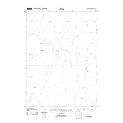
2012 Map of Millboro
USGS Topo · Published 2012About this map
Millboro sits as the central settlement in this portion of Tripp County, South Dakota, positioned just north of the winding Keya Paha River. The surrounding landscape is defined by a dendritic drainage pattern where several significant watercourses, including Willow Cr and Lost Cr, converge toward the river valley. A strictly organized grid of rural roads, such as 311th Ave and 299th St, segments the territory, reflecting the long-established section-line surveying traditions of the Great Plains. To the east, the course of Cottonwood Cr provides a prominent natural boundary in an otherwise geometrically ordered agricultural landscape. This survey demonstrates the persistence of small rural hubs like Millboro within the vast expanses of the northern prairie.
Find a feature on this map
19 named features on this map. Tap any name to fly to it.
Don’t see what you’re looking for? This feature index may not catch every label — zoom into the map to look around manually.
Map Details
Editions of this 2012 Millboro Map
This is the sole edition of this map. No revisions or reprints were ever made.
Other maps of this area

1950 · Norden
USGS Topo · 1:62,500

1952 · Norden
USGS Topo · 1:62,500

1955 · Martin
USGS Topo · 1:250,000

1955 · Mitchell
USGS Topo · 1:250,000

1955 · O'Neill
USGS Topo · 1:250,000

1957 · Valentine
USGS Topo · 1:250,000

1958 · Martin
USGS Topo · 1:250,000

1959 · Valentine
USGS Topo · 1:250,000

1959 · O'Neill
USGS Topo · 1:250,000

1959 · Mitchell
USGS Topo · 1:250,000