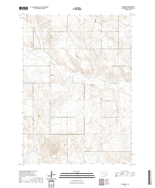
2021 Map of Millboro
USGS Topo · Published 2021About this map
The Millboro settlement and surrounding plains in Tripp County are defined by the meandering course of the Keya Paha River, which cuts a distinct valley through this section of the South Dakota landscape. The map reveals a highly structured grid of section lines and local roads, including 310th Ave and 312th Ave, which serve the agricultural region near the Nebraska border. Genealogy and local history researchers will find the Ascension Chapel Cem south of the river, a notable landmark in this rural territory. Drainage for the upland areas is provided by several named tributaries, such as Willow Cr, Cottonwood Cr, and Last Cr, illustrating the hydrographic network that supported the early homesteads and ranching operations of the South Dakota prairie.
Find a feature on this map
22 named features on this map. Tap any name to fly to it.
Don’t see what you’re looking for? This feature index may not catch every label — zoom into the map to look around manually.
Map Details
Editions of this 2021 Millboro Map
This is the sole edition of this map. No revisions or reprints were ever made.
Other maps of this area

1950 · Norden
USGS Topo · 1:62,500

1952 · Norden
USGS Topo · 1:62,500

1955 · Martin
USGS Topo · 1:250,000

1955 · Mitchell
USGS Topo · 1:250,000

1955 · O'Neill
USGS Topo · 1:250,000

1957 · Valentine
USGS Topo · 1:250,000

1958 · Martin
USGS Topo · 1:250,000

1959 · Valentine
USGS Topo · 1:250,000

1959 · O'Neill
USGS Topo · 1:250,000

1959 · Mitchell
USGS Topo · 1:250,000