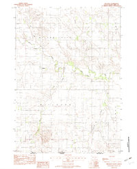
1982 Map of Millboro
USGS Topo · Published 1982About this map
Millboro sits near the winding course of the Keya Paha River in this survey of the borderlands between Tripp County, South Dakota, and Keya Paha County, Nebraska. The landscape is defined by a network of seasonal drainages, including Willow Creek, Lost Creek, and Cottonwood Creek, which carve through the plains. Local infrastructure in the early 1980s is centered on small-scale resource extraction and rural landmarks, such as the Gravel & Sand Pit and a local Cem. The presence of the Roadside Park along the highway and the Rames water feature reflect the region's ranching and transit character. This map captures the township and range divisions near the state line, providing a precise record of property boundaries and local landmarks during a period of steady agricultural use.
Find a feature on this map
16 named features on this map. Tap any name to fly to it.
Don’t see what you’re looking for? This feature index may not catch every label — zoom into the map to look around manually.
Map Details
Editions of this 1982 Millboro Map
This is the sole edition of this map. No revisions or reprints were ever made.
Other maps of this area

1950 · Norden
USGS Topo · 1:62,500

1952 · Norden
USGS Topo · 1:62,500

1955 · Martin
USGS Topo · 1:250,000

1955 · Mitchell
USGS Topo · 1:250,000

1955 · O'Neill
USGS Topo · 1:250,000

1957 · Valentine
USGS Topo · 1:250,000

1958 · Martin
USGS Topo · 1:250,000

1959 · Valentine
USGS Topo · 1:250,000

1959 · O'Neill
USGS Topo · 1:250,000

1959 · Mitchell
USGS Topo · 1:250,000