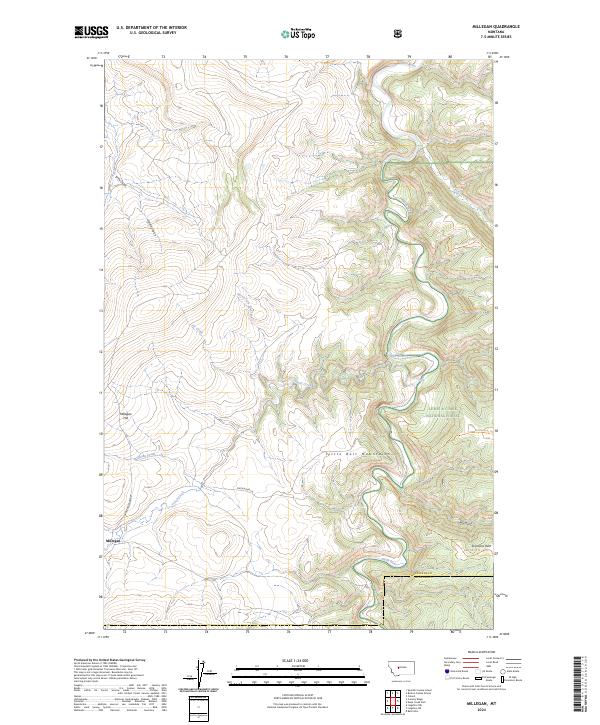
2024 Map of Millegan
USGS Topo · Published 2024About this map
The Millegan settlement and its namesake Millegan Hill anchor the western edge of this landscape, where the high plains meet the eastern rise of the Little Belt Mountains. This 2024 survey captures the transitional geography of the Lewis & Clark National Forest, where the deep winding canyon of the Smith River cuts through the terrain. The map documents the intricate drainage network feeding into this corridor, including Trout Creek, Spring Creek, and Deep Creek, alongside numerous gulches and coulees that define the local topography. This area remains largely defined by its rural access points, such as Upper Millegan Rd and Smith River Ln, which connect remote homesteads to the rugged interior. For those tracing the history of Central Montana ranching and public land use, the map provides precise locations for Simmons Park and several established backcountry routes like the Bear Gulch Trl and Parker Ridge Trl.
Find a feature on this map
27 named features on this map. Tap any name to fly to it.
Don’t see what you’re looking for? This feature index may not catch every label — zoom into the map to look around manually.
Map Details
Editions of this 2024 Millegan Map
This is the sole edition of this map. No revisions or reprints were ever made.
Other maps of this area

1886 · Great Falls
USGS Topo · 1:250,000

1886 · Fort Logan
USGS Topo · 1:250,000

1948 · White Sulphur Springs
USGS Topo · 1:250,000

1954 · Great Falls
USGS Topo · 1:250,000

1957 · Great Falls
USGS Topo · 1:250,000

1958 · White Sulphur Springs
USGS Topo · 1:250,000

1961 · White Sulphur Springs
USGS Topo · 1:250,000

1965 · White Sulphur Springs
USGS Topo · 1:250,000

1966 · Lingshire NE
USGS Topo · 1:24,000
1966 · Lingshire NW
USGS Topo · 1:24,000