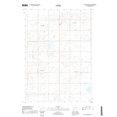
2017 Map of Miller Dale Colony NW
USGS Topo · Published 2017About this map
Ree Hills rise prominently in the northern section of this Hand County landscape, creating a distinct topographic break in an area primarily defined by high plains and drainage patterns. The settlement of Ree Heights sits at the edge of these elevations, serving as a focal point for a network of rural roads such as Green Valley Rd and Sivertsen Pl. This 2017 survey by the U.S. Geological Survey details the seasonal hydrology of the region, where Little Turtle Cr and Elm Cr carve subtle paths through the sections. The map reveals a land divided into large agricultural blocks, marked by section lines and family-named roads like Cook Pl, reflecting the enduring settlement patterns and land use of central South Dakota.
Find a feature on this map
22 named features on this map. Tap any name to fly to it.
Don’t see what you’re looking for? This feature index may not catch every label — zoom into the map to look around manually.
Map Details
Editions of this 2017 Miller Dale Colony NW Map
This is the sole edition of this map. No revisions or reprints were ever made.
Other maps of this area

1950 · Ree Heights SE
USGS Topo · 1:24,000

1950 · Ree Heights
USGS Topo · 1:24,000

1950 · Highmore SE
USGS Topo · 1:24,000

1953 · Huron
USGS Topo · 1:250,000

1954 · Huron
USGS Topo · 1:250,000

1973 · Ames
USGS Topo · 1:24,000

1973 · Macs Corner NE
USGS Topo · 1:24,000

1973 · Miller Dale Colony SW
USGS Topo · 1:24,000

1973 · Macs Corner SE
USGS Topo · 1:24,000
1973 · Miller Dale Colony NW
USGS Topo · 1:24,000