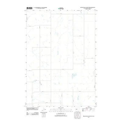
2012 Map of Miller Dale Colony SW
USGS Topo · Published 2012About this map
Cedar Cem stands as a quiet landmark within the rural section of Hand County, illustrating the sparse settlement patterns typical of this portion of South Dakota. The landscape is defined by a rigorous grid of section-line roads, including Lawler Rd, 347th Ave, and 216th St, which partition the prairie into large agricultural blocks. Hydrological features like Sand Cr and numerous small ephemeral depressions break the geometric regularity of the surveyed land, showing how natural drainage dictates the local topography. This 2012 survey captures the enduring character of the High Plains, where the infrastructure is built primarily to support large-scale farming and ranching, with few concentrated residential developments.
Find a feature on this map
19 named features on this map. Tap any name to fly to it.
Don’t see what you’re looking for? This feature index may not catch every label — zoom into the map to look around manually.
Map Details
Editions of this 2012 Miller Dale Colony SW Map
This is the sole edition of this map. No revisions or reprints were ever made.
Other maps of this area

1953 · Huron
USGS Topo · 1:250,000

1954 · Huron
USGS Topo · 1:250,000

1966 · Big Bend Dam NE
USGS Topo · 1:24,000

1973 · Ames
USGS Topo · 1:24,000

1973 · Macs Corner NE
USGS Topo · 1:24,000

1973 · Miller Dale Colony SW
USGS Topo · 1:24,000

1973 · Big Bend Dam 4 NW
USGS Topo · 1:24,000

1973 · Macs Corner SE
USGS Topo · 1:24,000

1973 · Big Bend Dam 4 NE
USGS Topo · 1:24,000
1973 · Miller Dale Colony NW
USGS Topo · 1:24,000