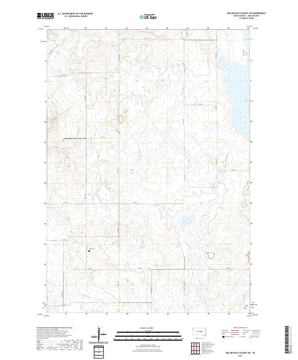
2021 Map of Miller Dale Colony SW
USGS Topo · Published 2021About this map
The prairie landscape of Hand County is defined by a grid of rural sections and scattered prairie potholes. Cedar Cem stands as a quiet landmark for local genealogists near the intersection of 215th St and 348th Ave, while the seasonal waters of Sand Cr and the marshy expanse of Collins Slough dictate the movement of water across the plains. This region, primarily organized under the Public Land Survey System, shows a network of county roads such as Co Rd 22 and Lawler Rd that follow the section lines, providing access to the remote homesteads and agricultural tracts of T110N and T111N. The map reveals the persistence of rural infrastructure in a sparsely populated territory where drainage features like sloughs are as vital to the geography as the road network itself.
Find a feature on this map
25 named features on this map. Tap any name to fly to it.
Don’t see what you’re looking for? This feature index may not catch every label — zoom into the map to look around manually.
Map Details
Editions of this 2021 Miller Dale Colony SW Map
This is the sole edition of this map. No revisions or reprints were ever made.
Other maps of this area

1953 · Huron
USGS Topo · 1:250,000

1954 · Huron
USGS Topo · 1:250,000

1966 · Big Bend Dam NE
USGS Topo · 1:24,000

1973 · Ames
USGS Topo · 1:24,000

1973 · Macs Corner NE
USGS Topo · 1:24,000

1973 · Miller Dale Colony SW
USGS Topo · 1:24,000

1973 · Big Bend Dam 4 NW
USGS Topo · 1:24,000

1973 · Macs Corner SE
USGS Topo · 1:24,000

1973 · Big Bend Dam 4 NE
USGS Topo · 1:24,000
1973 · Miller Dale Colony NW
USGS Topo · 1:24,000