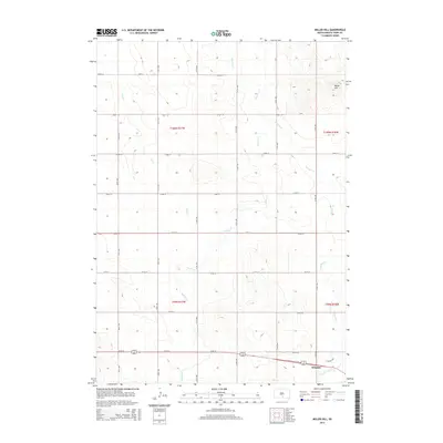
2015 Map of Miller Hill
USGS Topo · Published 2015About this map
Winner occupies the southeastern corner of this landscape, serving as a primary point of reference in Tripp County. The terrain is defined by the prominent Miller Hill in the northeast, while the rest of the area is carved by a network of drainage systems including Owl Cr, Hollow Cr, and Dog Ear Cr. The township and range boundaries of t100n r77w, t100n r76w, t99n r77w, and t99n r76w organize the vast agricultural grid. The map's strictly rectilinear road network, comprised of numbered avenues such as 311th Ave and streets like 273rd St, illustrates the systematic land division typical of the Great Plains. This survey captures the relationship between the concentrated development in Winner and the surrounding expansive grazing or farming lands before the topography rises sharply toward the northern summits.
Find a feature on this map
24 named features on this map. Tap any name to fly to it.
Don’t see what you’re looking for? This feature index may not catch every label — zoom into the map to look around manually.
Map Details
Editions of this 2015 Miller Hill Map
This is the sole edition of this map. No revisions or reprints were ever made.
Other maps of this area

1955 · Martin
USGS Topo · 1:250,000

1955 · Mitchell
USGS Topo · 1:250,000

1958 · Martin
USGS Topo · 1:250,000

1959 · Mitchell
USGS Topo · 1:250,000

1982 · Presho 4 SE
USGS Topo · 1:25,000

1982 · King Dam
USGS Topo · 1:25,000

1982 · Winner North
USGS Topo · 1:25,000

1982 · Witten SE
USGS Topo · 1:25,000

1982 · Witten
USGS Topo · 1:25,000

1982 · Winner South
USGS Topo · 1:25,000