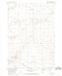
1967 Map of Miller SE
USGS Topo · Published 1968About this map
The Chicago and North Western railway cuts across the southern portion of this Hand County landscape, signaling the transport-driven development of South Dakota's prairie regions during the mid-20th century. The terrain is characterized by the convergence of several waterways, including Little Turtle Creek, Ree Creek, and the headwaters of Pearl Creek, which define the township divisions of York, Gilbert, St Lawrence, and Grand.
Find a feature on this map
16 named features on this map. Tap any name to fly to it.
Don’t see what you’re looking for? This feature index may not catch every label — zoom into the map to look around manually.
Map Details
Editions of this 1967 Miller SE Map
This is the sole edition of this map. No revisions or reprints were ever made.
Other maps of this area

1899 · Redfield
USGS Topo · 1:125,000

1950 · Vayland
USGS Topo · 1:24,000

1950 · Wessington
USGS Topo · 1:24,000

1950 · Vayland NW
USGS Topo · 1:24,000

1953 · Huron
USGS Topo · 1:250,000

1954 · Huron
USGS Topo · 1:250,000

1966 · Burdette
USGS Topo · 1:24,000

1967 · Tulare NW
USGS Topo · 1:24,000

1967 · Miller
USGS Topo · 1:24,000
1967 · Tulare SW
USGS Topo · 1:24,000