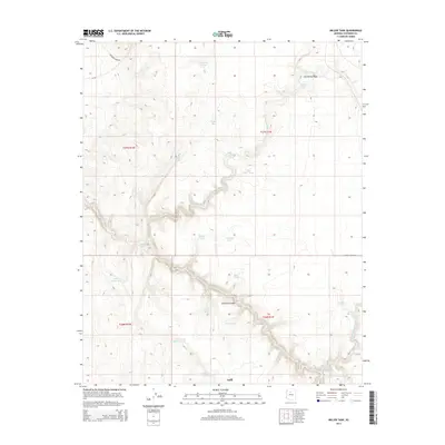
2014 Map of Miller Tank
USGS Topo · Published 2014About this map
The high desert landscape of Coconino County is defined here by the deep incision of Cataract Canyon and its seasonal drainage, Cataract Cr. In this arid environment, water management is the primary marker of human presence, as evidenced by a network of named catchment basins such as Wedding Tank, Lumpkin Tank, and Miller Tank. These features represent essential infrastructure for ranching and survival in the plateau country south of the Grand Canyon. The settlement of Valle sits near the southern edge of the sheet, serving as a crossroads where W Valle Tank Rd meets local arteries. The terrain is further etched by numerous washes, including Miller Wash, Red Horse Wash, and Spring Valley Wash, which channel intermittent runoff through the expansive flats of the Kaibab Plateau region.
Find a feature on this map
29 named features on this map. Tap any name to fly to it.
Don’t see what you’re looking for? This feature index may not catch every label — zoom into the map to look around manually.
Map Details
Editions of this 2014 Miller Tank Map
This is the sole edition of this map. No revisions or reprints were ever made.
Other maps of this area

1886 · Chino
USGS Topo · 1:250,000

1891 · Chino
USGS Topo · 1:250,000

1948 · Williams
USGS Topo · 1:250,000

1954 · Williams
USGS Topo · 1:250,000

1956 · Williams
USGS Topo · 1:250,000

1960 · Williams
USGS Topo · 1:250,000

1961 · Williams
USGS Topo · 1:250,000

1962 · Valle
USGS Topo · 1:62,500

1979 · Little Harpo Canyon
USGS Topo · 1:24,000
1979 · Howard Hill
USGS Topo · 1:24,000