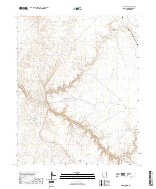
2021 Map of Miller Tank
USGS Topo · Published 2021About this map
Cataract Canyon carves a deep path through the southern half of this landscape, its steep walls and winding course defining the local geography alongside Cataract Cr. In this high desert environment, water management is the primary marker of human activity. The map reveals a dense network of catchment basins such as Miller Tank, Babbitt Tank, and Wedding Tank, which are essential for livestock and local land use. While the terrain is largely open, the presence of N Falcon Ridge Rd and various tracks indicate the continued importance of ranching and range access.
Find a feature on this map
27 named features on this map. Tap any name to fly to it.
Don’t see what you’re looking for? This feature index may not catch every label — zoom into the map to look around manually.
Map Details
Editions of this 2021 Miller Tank Map
This is the sole edition of this map. No revisions or reprints were ever made.
Other maps of this area

1886 · Chino
USGS Topo · 1:250,000

1891 · Chino
USGS Topo · 1:250,000

1948 · Williams
USGS Topo · 1:250,000

1954 · Williams
USGS Topo · 1:250,000

1956 · Williams
USGS Topo · 1:250,000

1960 · Williams
USGS Topo · 1:250,000

1961 · Williams
USGS Topo · 1:250,000

1962 · Valle
USGS Topo · 1:62,500

1979 · Little Harpo Canyon
USGS Topo · 1:24,000
1979 · Howard Hill
USGS Topo · 1:24,000