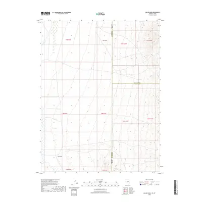
2018 Map of Miller Wash
USGS Topo · Published 2018About this map
Miller Mountain anchors the southeastern corner of this arid landscape where the high desert terrain of Utah meets the Nevada state line. This boundary region is defined by the convergence of four counties—Millard, Beaver, Lincoln, and Iron—marking a remote point of administrative intersection. The topography is shaped by the drainage patterns of Miller Wash and Hyde Wash, which reveal the complex drainage systems of the Great Basin. While few permanent structures are noted, the map provides a precise layout of the Public Land Survey System, including Township 8 North, Range 71 East and Township 26 South, Range 20 West, illustrating the methodical grid overlaying this uninhabited western borderland.
Find a feature on this map
17 named features on this map. Tap any name to fly to it.
Don’t see what you’re looking for? This feature index may not catch every label — zoom into the map to look around manually.
Map Details
Editions of this 2018 Miller Wash Map
This is the sole edition of this map. No revisions or reprints were ever made.
Other maps of this area

1953 · Richfield
USGS Topo · 1:250,000

1956 · Lund
USGS Topo · 1:250,000

1958 · Richfield
USGS Topo · 1:250,000

1960 · Lund
USGS Topo · 1:250,000

1971 · Mountain Home Pass
USGS Topo · 1:24,000

1971 · Mormon Gap
USGS Topo · 1:24,000

1972 · Rosencrans Knolls
USGS Topo · 1:24,000

1972 · Hamlin Well
USGS Topo · 1:24,000

1972 · Miller Wash
USGS Topo · 1:24,000

1972 · Hyde Well
USGS Topo · 1:24,000