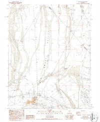
1987 Map of Millers
USGS Topo · Published 1987About this map
The Big Smoky Valley dominates this arid landscape at the boundary of Nye and Esmeralda counties. Near the base of the valley, the settlement of Millers appears as a hub of industrial activity, characterized by extensive tailings, ponds, and a substation that support local mining operations. A levee and a Bor Pit are situated near the edge of a large Dry Lake, suggesting the management of water and resources in this desert environment.
Find a feature on this map
21 named features on this map. Tap any name to fly to it.
Don’t see what you’re looking for? This feature index may not catch every label — zoom into the map to look around manually.
Map Details
Editions of this 1987 Millers Map
This is the sole edition of this map. No revisions or reprints were ever made.
Other maps of this area

1907 · Tonopah
USGS Topo · 1:250,000

1908 · Tonopah
USGS Topo · 1:250,000

1956 · Tonopah
USGS Topo · 1:250,000

1959 · Tonopah
USGS Topo · 1:250,000

1961 · Lone Mtn
USGS Topo · 1:62,500

1962 · Tonopah
USGS Topo · 1:250,000

1964 · San Antonio Ranch
USGS Topo · 1:62,500
1968 · Crow Springs
USGS Topo · 1:24,000
1968 · Gilbert SE
USGS Topo · 1:24,000
1980 · Outlaw Springs SE
USGS Topo · 1:24,000