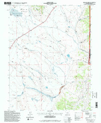
1994 Map of Milligan Lakes
USGS Topo · Published 1998About this map
King Coal Mine and scattered remnants of tailings represent the industrial legacy of this Park County landscape, which by the late 20th century was largely defined by water management and high-altitude ranching. The intricate network of irrigation channels, including the North Branch South Park Ditch, Whitten Ditch, and Packer Ditch, illustrates the complex engineering required to sustain agriculture in the region. Ranching operations such as Collard Ranch (Headquarters), Rocker-Seven Ranch, and Wahl Ranch are prominent landmarks, oriented around the flow of Michigan Creek and Tarryall Creek. The map also highlights the Michigan Creek / Teter State Wildlife Area and portions of the Pike National Forest, where features like Fremont Knoll and Michigan Hill rise above the gulches. This survey provides a clear view of the rural infrastructure, from the Cline Reservoir to the isolated Fire Station along the local road system.
Find a feature on this map
55 named features on this map. Tap any name to fly to it.
Don’t see what you’re looking for? This feature index may not catch every label — zoom into the map to look around manually.
Map Details
Editions of this 1994 Milligan Lakes Map
This is the sole edition of this map. No revisions or reprints were ever made.
Other maps of this area

1937 · Como
USGS Topo · 1:62,500

1945 · Mount Logan
USGS Topo · 1:24,000

1948 · Mount Logan
USGS Topo · 1:24,000

1953 · Denver
USGS Topo · 1:250,000

1956 · Eagle Rock
USGS Topo · 1:24,000

1956 · Elkhorn
USGS Topo · 1:24,000

1956 · Fairplay East
USGS Topo · 1:24,000

1957 · Denver
USGS Topo · 1:250,000
1957 · Boreas Pass
USGS Topo · 1:24,000
1957 · Milligan Lakes
USGS Topo · 1:24,000