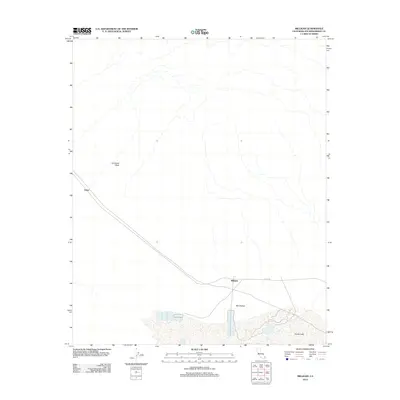
2012 Map of Milligan
USGS Topo · Published 2012About this map
Milligan and Fishel anchor this desert landscape in eastern San Bernardino County, where human infrastructure intersects with a massive dry lakebed system. The southern portion of the map is dominated by the sprawling expanse of Danby Lake, a prominent alkali flat that serves as a terminus for local drainage. Extending northward from this basin, Ward Valley provides a broad corridor through the arid terrain, shaped by ephemeral watercourses such as Ironwood Wash. Transportation in this isolated region is defined by the diagonal passage of the railroad and the parallel route of Cadiz Rd, which connect these small settlements across the high desert. The map captures the specialized land use around the dry lake, featuring organized evaporation ponds or industrial works indicative of salt or mineral harvesting that has long characterized the Mojave's interior basins.
Find a feature on this map
6 named features on this map. Tap any name to fly to it.
Don’t see what you’re looking for? This feature index may not catch every label — zoom into the map to look around manually.
Map Details
Editions of this 2012 Milligan Map
This is the sole edition of this map. No revisions or reprints were ever made.
Other maps of this area

1942 · Amboy
USGS Topo · 1:250,000

1943 · Amboy
USGS Topo · 1:250,000

1943 · Cadiz Lake
USGS Topo · 1:62,500

1943 · Cadiz Valley
USGS Topo · 1:62,500

1943 · Iron Mountains
USGS Topo · 1:62,500

1954 · Needles
USGS Topo · 1:250,000

1956 · Needles
USGS Topo · 1:250,000

1956 · Milligan
USGS Topo · 1:62,500

1956 · Iron Mountains
USGS Topo · 1:62,500

1956 · Cadiz Lake
USGS Topo · 1:62,500