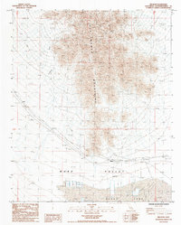
1985 Map of Milligan
USGS Topo · Published 1985About this map
The Old Woman Mountains dominate the northern terrain of this Mojave Desert landscape, casting shadows over the expansive Ward Valley below. This mid-1980s survey details a region defined by industrial extraction and stark topography. To the south, the dry bed of Danby Lake is partitioned into large Salt Evaporators, accompanied by a significant Spoil Bank, illustrating the area's role in mineral production.
Find a feature on this map
13 named features on this map. Tap any name to fly to it.
Don’t see what you’re looking for? This feature index may not catch every label — zoom into the map to look around manually.
Map Details
Editions of this 1985 Milligan Map
This is the sole edition of this map. No revisions or reprints were ever made.
Other maps of this area

1942 · Amboy
USGS Topo · 1:250,000

1943 · Amboy
USGS Topo · 1:250,000

1943 · Cadiz Lake
USGS Topo · 1:62,500

1943 · Cadiz Valley
USGS Topo · 1:62,500

1943 · Iron Mountains
USGS Topo · 1:62,500

1954 · Needles
USGS Topo · 1:250,000

1956 · Needles
USGS Topo · 1:250,000

1956 · Milligan
USGS Topo · 1:62,500

1956 · Iron Mountains
USGS Topo · 1:62,500

1956 · Cadiz Lake
USGS Topo · 1:62,500