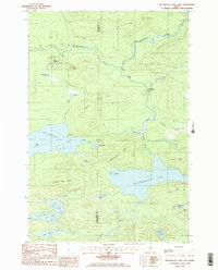
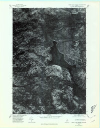
1985 Map of Millinocket Lake East
USGS Topo · Published 1986About this map
The Aroostook River and Munsungan Stream define the northern drainage of this timber-rich landscape, where industrial logging activity is recorded at the Isthmus Logging Camp and Moosehorn Crossing. The terrain is shaped by distinct glacial features and ridges, including Old Baldface, Libby Pinnacle, and Woodlot Ridge, which separate a dense network of water bodies. The presence of numerous camps like Libby Camp and a complex system of private roads indicates the region's managed wilderness character during the mid-1980s. Southward, the map covers the expansive waters of Millinocket Lake and Millimagassett Lake, fed by the Millimagassett Stream. Smaller, isolated waters such as Tilly Pond, Soule Pond, and Ireland Pond are tucked between landmarks like Atkins Ridge and Beaver Pond Ridge, illustrating the intricate hydrology of the Maine woods before modern expansion.
Find a feature on this map
40 named features on this map. Tap any name to fly to it.
Don’t see what you’re looking for? This feature index may not catch every label — zoom into the map to look around manually.
Map Details
Editions of this 1985 Millinocket Lake East Map
2 editions found
Other maps of this area

1954 · Shin Pond
USGS Topo · 1:62,500

1954 · Millinocket Lake
USGS Topo · 1:62,500

1954 · Grand Lake Seboeis
USGS Topo · 1:62,500

1954 · Presque Isle
USGS Topo · 1:250,000

1955 · Traveler Mountain
USGS Topo · 1:62,500

1958 · Presque Isle
USGS Topo · 1:250,000

1960 · Presque Isle
USGS Topo · 1:250,000
1975 · Shin Pond NW
USGS Topo · 1:24,000
1975 · Grand Lake Seboeis NW
USGS Topo · 1:24,000
1975 · Grand Lake Seboeis SW
USGS Topo · 1:24,000