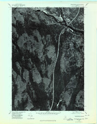
1975 Map of Millinocket SE
USGS Topo · Published 1980About this map
The West Branch Penobscot River cuts across the northern edge of this orthophotoquad, defining the industrial and residential corridors of East Millinocket and Medway during the mid-1970s. This aerial imagery captures a moment in Maine's timber and paper-milling history, showing the clear footprint of organized development along the river contrasted with the dense, water-laced woodlands to the south.
Find a feature on this map
7 named features on this map. Tap any name to fly to it.
Don’t see what you’re looking for? This feature index may not catch every label — zoom into the map to look around manually.
Map Details
Editions of this 1975 Millinocket SE Map
This is the sole edition of this map. No revisions or reprints were ever made.
Other maps of this area

1920 · Winn
USGS Topo · 1:62,500

1940 · Mattawamkeag
USGS Topo · 1:62,500

1942 · Lincoln
USGS Topo · 1:62,500

1942 · Mattawamkeag
USGS Topo · 1:62,500

1951 · Millinocket
USGS Topo · 1:62,500

1954 · Millinocket
USGS Topo · 1:250,000

1957 · Lincoln
USGS Topo · 1:62,500

1958 · Millinocket
USGS Topo · 1:250,000

1960 · Millinocket
USGS Topo · 1:250,000
1960 · Winn
USGS Topo · 1:62,500