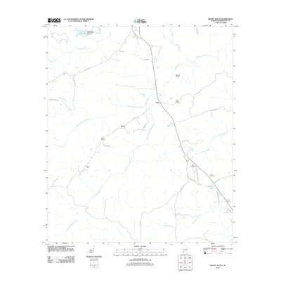
2011 Map of Millry South
USGS Topo · Published 2011About this map
The rural landscape of southwestern Alabama unfolds around the settlements of Loper, Barlow, and Yarbo, showing a region defined by its complex drainage network and isolated community centers. Small family-named landmarks like Nannie Chufa and several burial grounds, including Rocky Ridge Cemetery and Reynolds Cemetery, provide vital geographic markers for genealogists tracing lineage in this part of Washington County. The terrain is characterized by the confluence of numerous waterways such as Santa Bogue Creek, Pine Barren Creek, and the prongs of Taylors Creek, which converge as they flow toward the south and east. In the north, Emmit Wood Lake and the Washington County Public Lake Dam represent significant water management features. The road system, with routes like Dearman Fork Rd and Woodrow Reynolds Rd, reflects a pattern of rural development where infrastructure follows the contours of the timber-rich land.
Find a feature on this map
42 named features on this map. Tap any name to fly to it.
Don’t see what you’re looking for? This feature index may not catch every label — zoom into the map to look around manually.
Map Details
Editions of this 2011 Millry South Map
This is the sole edition of this map. No revisions or reprints were ever made.
Other maps of this area

1943 · McIntosh
USGS Topo · 1:62,500

1944 · McIntosh
USGS Topo · 1:62,500

1953 · Hattiesburg
USGS Topo · 1:250,000

1958 · Hattiesburg
USGS Topo · 1:250,000

1971 · Bigbee
USGS Topo · 1:24,000

1971 · Bladon Springs
USGS Topo · 1:24,000

1974 · Millry South
USGS Topo · 1:24,000

1974 · Chatom
USGS Topo · 1:24,000

1974 · State Line
USGS Topo · 1:24,000

1974 · Millry North
USGS Topo · 1:24,000