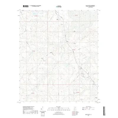
2018 Map of Millry South
USGS Topo · Published 2018About this map
Millry serves as the primary hub in this corner of Washington County, where a network of local roads like Millry Mill Rd and Washington Ave converge. The landscape is defined by the headwaters of numerous creeks, including Crosbys Cr and Bill Cr, which drain a terrain marked by small water bodies like Emmit Wood Lake and Highland Pond. To the south, smaller communities such as Loper, Barlow, and Yarbo are connected by rural routes including Barlow Rd and Jordan St, reflecting a dispersed settlement pattern characteristic of this timber and agricultural region. Genealogists will find several burial grounds documented across these townships, specifically the Barlow Cem, Rocky Ridge Cem, Yarbo Cem, and Reynolds Cem. These landmarks, along with the detailed PLSS grid from t8n r4w down to t6n r3w, provide a clear view of property divisions and local geography as it existed in the late 2010s.
Find a feature on this map
50 named features on this map. Tap any name to fly to it.
Don’t see what you’re looking for? This feature index may not catch every label — zoom into the map to look around manually.
Map Details
Editions of this 2018 Millry South Map
This is the sole edition of this map. No revisions or reprints were ever made.
Other maps of this area

1943 · McIntosh
USGS Topo · 1:62,500

1944 · McIntosh
USGS Topo · 1:62,500

1953 · Hattiesburg
USGS Topo · 1:250,000

1958 · Hattiesburg
USGS Topo · 1:250,000

1971 · Bigbee
USGS Topo · 1:24,000

1971 · Bladon Springs
USGS Topo · 1:24,000

1974 · Millry South
USGS Topo · 1:24,000

1974 · Chatom
USGS Topo · 1:24,000

1974 · State Line
USGS Topo · 1:24,000

1974 · Millry North
USGS Topo · 1:24,000