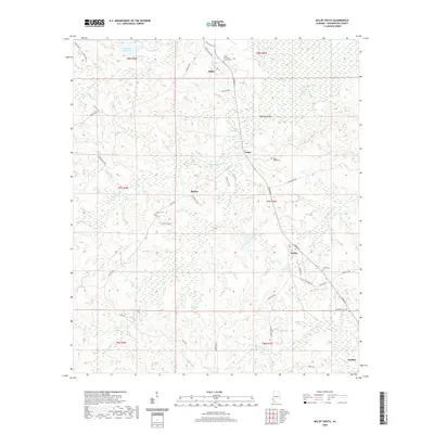
2020 Map of Millry South
USGS Topo · Published 2020About this map
Millry and its surrounding rural hamlets define this landscape in Washington County, where the upper reaches of the Santa Bogue Cr and Taylors Cr basins create a network of drainage across the timbered terrain. The settlement pattern is deeply connected to family history and long-standing community centers, evidenced by several scattered burial grounds such as the Millry Holiness Church Cem and Rocky Ridge Cem. Movement through this part of Alabama is facilitated by a grid of named local routes, including Washington Ave and Jordan St, which link the primary village of Millry to outlying areas like Loper, Barlow, and Yarbo. Small water bodies like Emmit Wood Lake and Highland Pond dot the map, providing landmarks in a territory characterized by numerous creek branches, including N Prong Taylors Cr and Little Bassetts Cr.
Find a feature on this map
51 named features on this map. Tap any name to fly to it.
Don’t see what you’re looking for? This feature index may not catch every label — zoom into the map to look around manually.
Map Details
Editions of this 2020 Millry South Map
This is the sole edition of this map. No revisions or reprints were ever made.
Other maps of this area

1943 · McIntosh
USGS Topo · 1:62,500

1944 · McIntosh
USGS Topo · 1:62,500

1953 · Hattiesburg
USGS Topo · 1:250,000

1958 · Hattiesburg
USGS Topo · 1:250,000

1971 · Bigbee
USGS Topo · 1:24,000

1971 · Bladon Springs
USGS Topo · 1:24,000

1974 · Millry South
USGS Topo · 1:24,000

1974 · Chatom
USGS Topo · 1:24,000

1974 · State Line
USGS Topo · 1:24,000

1974 · Millry North
USGS Topo · 1:24,000