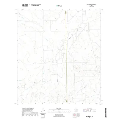
2019 Map of Mills Bennett
USGS Topo · Published 2019About this map
Billings Cem rests in the southwestern portion of this South Texas landscape, serving as a quiet focal point for local family history research in this ranching country. The terrain is defined by the winding course of Mesquitos Cr and a series of water management features essential for the arid environment, including Charo Tank, Middle Tank, and Home Tank. The settlement of Mills Bennett is situated near the center of the sheet, where Mills Bennett Rd and Superior Rd provide access through the brush country.
Find a feature on this map
15 named features on this map. Tap any name to fly to it.
Don’t see what you’re looking for? This feature index may not catch every label — zoom into the map to look around manually.
Map Details
Editions of this 2019 Mills Bennett Map
This is the sole edition of this map. No revisions or reprints were ever made.
Other maps of this area

1956 · Freer
USGS Topo · 1:62,500

1956 · Las Mujeres
USGS Topo · 1:62,500

1956 · Laredo
USGS Topo · 1:250,000

1968 · Parrilla Creek SW
USGS Topo · 1:24,000
1968 · Mills Bennett SW
USGS Topo · 1:24,000

1968 · Mills Bennett
USGS Topo · 1:24,000

1968 · Parrilla Creek NW
USGS Topo · 1:24,000

1968 · Mills Bennett NW
USGS Topo · 1:24,000

1968 · San Pablo
USGS Topo · 1:24,000
1971 · Sarnosa Hill
USGS Topo · 1:24,000