
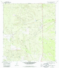
1968 Map of Parrilla Creek SW
USGS Topo · Published 1971About this map
Agua Poquita Creek and Macho Creek define the drainage of this Duval County landscape, where the late 1960s ranching economy relied heavily on a sophisticated network of groundwater infrastructure. Numerous windmills, often carrying distinctive names like the Javalina Windmill, Callejon Windmill, and Savage Windmill, are scattered across the brush country to support livestock at remote water sources.
Find a feature on this map
29 named features on this map. Tap any name to fly to it.
Don’t see what you’re looking for? This feature index may not catch every label — zoom into the map to look around manually.
Map Details
Editions of this 1968 Parrilla Creek SW Map
2 editions found
Other maps of this area

1939 · Bruni
USGS Topo · 1:62,500

1956 · Laredo
USGS Topo · 1:250,000

1967 · Parrilla Creek SE
USGS Topo · 1:24,000

1967 · Realitos
USGS Topo · 1:24,000

1967 · Hebbronville NW
USGS Topo · 1:24,000

1968 · Mills Bennett
USGS Topo · 1:24,000

1968 · Parrilla Creek NW
USGS Topo · 1:24,000

1968 · Parrilla Creek NE
USGS Topo · 1:24,000

1968 · San Pablo
USGS Topo · 1:24,000
1972 · Bruni
USGS Topo · 1:24,000