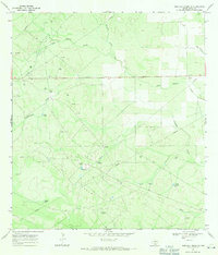
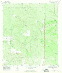
1967 Map of Parrilla Creek SE
USGS Topo · Published 1971About this map
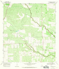
The Duval County landscape in the late 1960s was defined by an extensive Oil Field network, where industrial infrastructure integrated with traditional ranching lands. At the heart of this activity is Driscoll Camp, which features a central Refinery surrounded by a dense concentration of Oil Well and Gas Well sites. This intersection of energy and agriculture is further evidenced by the various family-named and functional landmarks like the Guadalupe Windmill and Medron Windmill, which provided essential water in a semi-arid environment drained by the intermittent Agua Poquita Creek and Concepcion Creek. The map also captures several Gravel Pits and cattle-related features such as Novillo Tank and the Spring Guajillo Tank, showing how the land was simultaneously managed for resource extraction and livestock.
Find a feature on this map
22 named features on this map. Tap any name to fly to it.
Don’t see what you’re looking for? This feature index may not catch every label — zoom into the map to look around manually.
Map Details
Editions of this 1967 Parrilla Creek SE Map
This is the sole edition of this map. No revisions or reprints were ever made.
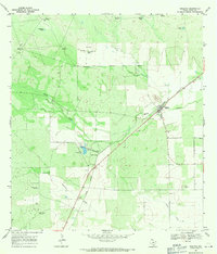
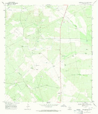
Other maps of this area

1921 · Falfurrias
USGS Topo · 1:125,000
1956 · Benavides
USGS Topo · 1:62,500

1956 · Laredo
USGS Topo · 1:250,000
1967 · Realitos
USGS Topo · 1:24,000
1967 · Hebbronville NW
USGS Topo · 1:24,000
1968 · Parrilla Creek SW
USGS Topo · 1:24,000
1968 · Benavides NW
USGS Topo · 1:24,000
1968 · Benavides
USGS Topo · 1:24,000
1968 · Parrilla Creek NW
USGS Topo · 1:24,000
1968 · Concepcion NW
USGS Topo · 1:24,000