
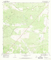
1968 Map of Benavides NW
USGS Topo · Published 1971About this map
Guerra Cem and Tinney Piedras Pintas Cem stand as quiet landmarks within this rural Duval County landscape, reflecting the local family history of the South Texas brush country. The area is defined by the ephemeral flow of Piedras Pintas Creek and Narciseno Creek, which cut through the undulating terrain. Industrial development is marked by an extensive network of pipelines and the established Texas Mexican Oil Field to the southeast. Transport history is visible along the Old Railroad Grade, tracing a path near several Salt Water Wells. This 1968 field-checked survey captures the transition of the land from traditional ranching toward increased energy extraction, while still retaining the names of the early settlers who established the region's small family cemeteries.
Find a feature on this map
11 named features on this map. Tap any name to fly to it.
Don’t see what you’re looking for? This feature index may not catch every label — zoom into the map to look around manually.
Map Details
Editions of this 1968 Benavides NW Map
This is the sole edition of this map. No revisions or reprints were ever made.
Other maps of this area

1956 · Benavides
USGS Topo · 1:62,500

1956 · Rosita Ranch
USGS Topo · 1:62,500

1956 · Freer
USGS Topo · 1:62,500

1956 · Laredo
USGS Topo · 1:250,000

1967 · Parrilla Creek SE
USGS Topo · 1:24,000

1968 · San Jose
USGS Topo · 1:24,000

1968 · Benavides
USGS Topo · 1:24,000

1968 · Parrilla Creek NE
USGS Topo · 1:24,000
1968 · Benavides NE
USGS Topo · 1:24,000
1968 · Rosita
USGS Topo · 1:24,000