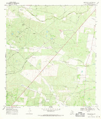
1968 Map of Benavides NE
USGS Topo · Published 1971About this map
Oil and ranching interests define this landscape in Duval County, where the Texas Mexican railroad cuts a straight diagonal across the brushland. The map reveals a network of industrial and family-named landmarks, most notably the Segura-Saenz Cem and Longoria Cem situated in the southern drainage of Guajillo Creek. These sites provide critical anchor points for genealogists tracing South Texas families in the mid-20th century.
Find a feature on this map
24 named features on this map. Tap any name to fly to it.
Don’t see what you’re looking for? This feature index may not catch every label — zoom into the map to look around manually.
Map Details
Editions of this 1968 Benavides NE Map
This is the sole edition of this map. No revisions or reprints were ever made.
Other maps of this area

1917 · Ben Bolt
USGS Topo · 1:62,500

1920 · San Diego
USGS Topo · 1:62,500

1956 · Benavides
USGS Topo · 1:62,500

1956 · Rosita Ranch
USGS Topo · 1:62,500

1956 · Laredo
USGS Topo · 1:250,000

1963 · San Diego
USGS Topo · 1:24,000

1963 · Ben Bolt NW
USGS Topo · 1:24,000
1963 · Palito Blanco
USGS Topo · 1:24,000

1968 · Benavides NW
USGS Topo · 1:24,000

1968 · San Jose
USGS Topo · 1:24,000