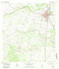
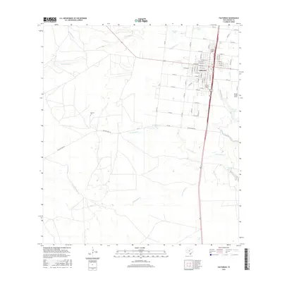
1921 Map of Falfurrias
USGS Topo · Published 1921About this map
The dairy and ranching heart of South Texas comes into focus here, mapped under the direction of Major Henry H. Robert during a period of agricultural expansion. The landscape is dotted with specialized operations like Laguna Larga Farm, Busy Bee Farm, and the Seymour Citrus Farm, reflecting the region's transition toward intensive cultivation. The town of Falfurrias serves as a central hub, while surrounding ranchlands are marked by extensive windmill systems such as Cachucha Windmill and Mesquites Windmill, which were essential for sustaining livestock in this arid environment.
Find a feature on this map
216 named features on this map. Tap any name to fly to it.
Don’t see what you’re looking for? This feature index may not catch every label — zoom into the map to look around manually.
Map Details
Editions of this 1921 Falfurrias Map
This is the sole edition of this map. No revisions or reprints were ever made.
Historical Maps of Falfurrias Through Time
8 maps found