Old Maps of Brooks County, Texas
Explore 189 old maps of Brooks County, spanning from 1921 to today. These high-resolution historic maps reveal how streets, neighborhoods, landmarks, and natural features evolved over time — perfect for genealogy, metal detecting, research, and local history exploration.
What you can do with these maps:
- See how Brooks County changed over time: Compare historical maps to modern-day views to trace roads, homesites, rail lines & more.
- View detailed metadata: Each map includes creators, publishers, year, scale, and archive source.
- Overlay maps with satellite & LiDAR: Visualize the past alongside modern tools to explore terrain & human change.
- Trusted historical sources: Maps sourced from the USGS, Library of Congress, and other archives.
- Access maps your way: View online, download high-res files, or order prints for personal or research use.
Start exploring old maps of Brooks County to uncover forgotten places, hidden landmarks, and the deep history beneath your feet.
Brooks County, TX maps
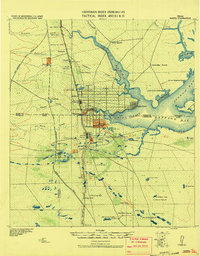
(189)- 1921 Map of Falfurrias
 1921 Falfurrias1921 Print · USGSBrooks and Jim Wells counties were defined by a sprawling ranching and citrus economy in the years following the Great War. Genealogists can trace family holdings and early infrastructure like Coyote Mills, the Concepcion Ruins, and the Seymour Citrus Farm.
 - 1923 Map of Armstrong
 1923 Armstrong1923 Print · USGSSouth Texas cattle country in the early twenties is defined by isolated ranching outposts and the vital rail corridor. Researchers can trace the early footprints of Armstrong and Norias or locate remote landmarks like Lorita Ranch and Chaparrazo Well.
 - 1928 Map of Sarita
 1928 Sarita1928 Print · USGSSouth Texas ranching country and the coastal prairies are shown here during the early twentieth century. Researchers can trace family-named holdings like Kennedy Farm, ranch outposts at Novillos Mott, and rail sidings at Mifflin.
 - 1939 Map of Encantada, 1959 Print
 1939 Encantada1959 Print · USGSBrooks and Starr counties are shown in the late 1930s as a landscape of established cattle ranches and emerging oil fields. Genealogists and researchers can locate family landmarks such as Guerra, Encantada Ranch, and La Particion Ranch.
 - 1949 Map of Mc Allen, 1954 Print
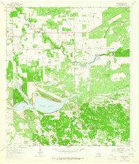
 1949 Mc Allen1954 Print · USGSThe Rio Grande Valley at mid-century reveals a bustling international corridor of citrus groves, rail lines, and growing border towns. Genealogists and historians can trace the Missouri Pacific RR through McAllen or locate rural landmarks like the Santa Fe School and Arkansas City.
 - 1950 Map of Corpus Christi, 1953 Print
 1950 Corpus Christi1953 Print · USGSThe South Texas coast comes into focus during the early fifties, showing the interplay between booming oil fields and expansive ranching operations. Genealogists and historians can trace the Texas Mexican rail line through Kingsville or locate heritage sites like Chapman Ranch and Riviera Beach.
 - 1953 Map of Brownsville
 1953 Brownsville1953 Print · USGSSouth Texas ranchlands and the Lower Rio Grande Valley are captured here in the early fifties as the region's irrigation and shipping networks expanded. Genealogists and historians can trace family landholdings like Tecolote Ranch or follow the route of the St Louis Brownsville and Mexico rail line through Sebastian and Yturria.
 - 1954 Map of McAllen
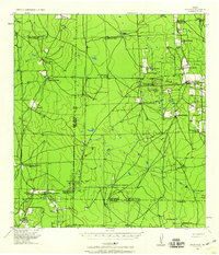
 1954 McAllen1954 Print · USGSCovers Brooks County, including Reynosa, McAllen, and other nearby areas
 - 1954 Map of Sarita, 1956 Print
 1954 Sarita1956 Print · USGSThe ranching heart of South Texas comes into focus in the mid-1950s, centered on the railroad town of Sarita. Researchers can trace the massive cattle estates of the era, including La Paloma Ranch, and follow the Missouri Pacific line through landmarks like Turcotte.
 - 1954 Map of Riviera, 1957 Print
 1954 Riviera1957 Print · USGSKleberg County in the mid-fifties is captured here as a landscape of military aviation, large-scale ranching, and emerging oil fields. Researchers can trace family windmills, old school sites like San Fernando Sch, and the grounds of the Texas and Mexican Industrial Institute.
 - 1956 Map of Corpus Christi
 1956 Corpus Christi1956 Print · USGSThe South Texas coast and the burgeoning port of Corpus Christi are captured here during the mid-fifties. Genealogists and historians can trace the rail-and-oil economy through labels like Robstown Airpark, Chapman Ranch, and the Missouri Pacific railroad.
 - 1956 Map of Pita Camp, 1957 Print
 1956 Pita Camp1957 Print · USGSThe ranchlands along the Brooks and Kenedy County line are mapped here in the mid-fifties, showing the essential water infrastructure of the era. Trace the locations of Pita Camp, Ball Ranch, and numerous landmarks like Zacahuistle Windmill.2 unique versions available
 - 1956 Map of Julian, 1957 Print
 1956 Julian1957 Print · USGSThe remote ranchlands of Kenedy and Brooks County are captured here in the mid-1950s, highlighting a landscape defined by industrial water management and oil exploration. Researchers can trace the network of private roads connecting Julian (Recycling Sta) and Chaparrosa Camp to numerous named sites like Candelaria Lake.2 unique versions available
 - 1956 Map of Armstrong, 1959 Print
 1956 Armstrong1959 Print · USGSKenedy County ranching and the rail corridor are preserved here in the mid-fifties. Researchers can trace the ranching economy at Armstrong Ranch Headquarters or find family history at the Norias Cem along the Missouri Pacific.
 - 1956 Map of Laredo, 1960 Print
 1956 Laredo1960 Print · USGSSouth Texas in the mid-fifties reveals a landscape shaped by border commerce, military aviation, and a booming oil industry. Trace the historic Texas and Mexican RR line through Hebbronville or locate the sprawling Mirando City Oil Field and Laredo AFB.3 unique versions available
 - 1956 Map of Brownsville, 1969 Print
 1956 Brownsville1969 Print · USGSThe Texas-Mexico borderlands and the Gulf coast come alive in this mid-century survey of the Rio Grande Valley. Genealogists and historians can trace the reach of the Missouri Pacific rail lines through citrus country to schools like Las Yescas and Palm Grove.2 unique versions available
 - 1956 Map of Port Isabel, 1983 Print
 1956 Port Isabel1983 Print · USGSCoastal Texas and the Rio Grande Valley are shown here in the mid-twentieth century as the region balanced intensive agriculture with maritime trade. Researchers can trace historic rail lines like the SOUTHERN PACIFIC and locate rural landmarks such as Las Yescas Sch or the Armstrong Ranch.
 - 1957 Map of Mc Allen, 1962 Print
 1957 Mc Allen1962 Print · USGSThe South Texas borderlands emerge in the late fifties as a hub of energy production and military activity. Researchers can trace the river economy through Rio Grande City, find the Brewster School, and locate the Moore Air Force Base.2 unique versions available
 - 1960 Map of Corpus Christi
 1960 Corpus Christi1960 Print · USGSCoastal South Texas and the Nueces County hinterlands are detailed in this mid-century survey. Genealogists and historians can trace early settlement patterns and rural landmarks like Casa Blanca during a period of steady regional growth.
 - 1962 Map of Brownsville
 1962 Brownsville1962 Print · USGSThe Lower Rio Grande Valley in the early sixties was a landscape of coastal wildlands, booming oil fields, and international border commerce. Trace the development of this frontier region through landmarks like Harlingen Air Force Base, Boca Chica Island, and the Willamar Oil Field.
 - 1962 Map of McAllen
 1962 McAllen1962 Print · USGSThe Lower Rio Grande Valley in the mid-twentieth century shows a complex landscape of irrigation, oil production, and border commerce. Genealogists and historians can trace family roots through riverside towns like Zapata, Roma-Los Saenz, and Hidalgo, or locate landmarks like Santa Elena Ch and Moore Air Force Base.
 - 1963 Map of Flowella, 1964 Print
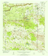
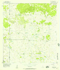
 1963 Flowella1964 Print · USGSBrooks County ranchlands in the early sixties show a landscape balancing traditional cattle operations with a growing oil economy. Researchers can trace family estates like Perez Ranch, visit the Pedro Jaramillo Cem, or locate the Gyp Hill Oil Field.
 - 1963 Map of Falfurrias SE, 1964 Print
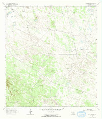 1963 Falfurrias SE1964 Print · USGSBrooks County ranchlands meet the South Texas energy boom in the early sixties. Researchers can trace historic ranch boundaries and water sources like Old Barroso Windmill alongside industrial developments in the Pita Oil Field.2 unique versions available
 - 1963 Map of Premont West, 1964 Print
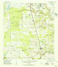
 1963 Premont West1964 Print · USGSJim Wells County in the early 1960s was a hub of energy production and ranching at the meeting point of three counties. Genealogists and historians can trace the Southern Pacific rail corridor through Premont and La Gloria, and locate rural landmarks like the La Gloria Sch and the Drive-in Theater.
 - 1963 Map of Cage Ranch, 1964 Print
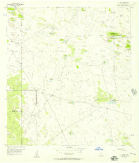
 1963 Cage Ranch1964 Print · USGSBrooks County is shown at the height of the early 1960s energy boom, where vast ranch lands meet industrial oil and gas fields. Researchers can trace family ranch boundaries like Cage Ranch and the rail stop at Dixie along the Southern Pacific line.
Showing maps 1-25 of 189
Top cities of Brooks County
Frequently asked questions
- What are the different types of historical maps available for Brooks County?
- What is the oldest map of Brooks County?
- Where can I purchase historical maps of Brooks County for my home or office?
- Where can I download high-res historical maps of Brooks County?
- Are there historical topographic maps available for Brooks County?
- Is there historical aerial imagery available for Brooks County?
- Where are historical maps of Brooks County sourced from?