
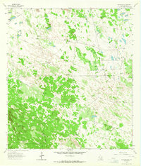
1963 Map of Falfurrias SE
USGS Topo · Published 1964About this map
Shifting Sand Dunes and ranching infrastructure define this corner of Brooks County during the early 1960s. The landscape is a functional grid of large livestock enclosures, including Barroso Pasture and Los Muertos Pasture, where survival depends on a network of named water sources like Medio Windmill, Mota Bonita Windmill, and La Sulfurosa Windmill.
Find a feature on this map
40 named features on this map. Tap any name to fly to it.
Don’t see what you’re looking for? This feature index may not catch every label — zoom into the map to look around manually.
Map Details
Editions of this 1963 Falfurrias SE Map
2 editions found
Other maps of this area

1921 · Falfurrias
USGS Topo · 1:125,000

1923 · Armstrong
USGS Topo · 1:62,500

1928 · Sarita
USGS Topo · 1:125,000

1949 · Mc Allen
USGS Topo · 1:250,000

1950 · Corpus Christi
USGS Topo · 1:250,000

1953 · Brownsville
USGS Topo · 1:250,000

1954 · McAllen
USGS Topo · 1:250,000

1954 · Sarita
USGS Topo · 1:62,500

1956 · Corpus Christi
USGS Topo · 1:250,000

1956 · Pita Camp
USGS Topo · 1:24,000