1960s Maps of Brooks County, Texas
Explore 21 historic maps of Brooks County from the 1960s. These maps offer a rare glimpse into what life looked like during the 1960s — showing old roads, neighborhoods, homes, and landmarks that have changed or disappeared over time.
Whether you're researching your family's past, planning a metal detecting trip, or studying how Brooks County's landscape evolved across the 1960s, these high-resolution maps are a powerful tool for exploring the history of this region.
- Focus on a specific era: All maps on this page are from the 1960s, giving you a focused view of this time period.
- See what’s changed: Compare century-old streets, trails, and buildings to today's modern landscape using overlays and satellite layers.
- Research with precision: Use these maps for genealogy, historical research, land use analysis, or educational projects.
- View, download, or print: Maps are fully viewable online in high resolution, and can be downloaded or printed for your own records.
Start exploring Brooks County's history through authentic maps from the 1960s. This is your window into the past.
Brooks County, TX maps
(21)- 1960 Map of Corpus Christi
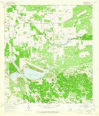
 1960 Corpus Christi1960 Print · USGSCoastal South Texas and the Nueces County hinterlands are detailed in this mid-century survey. Genealogists and historians can trace early settlement patterns and rural landmarks like Casa Blanca during a period of steady regional growth.
 - 1962 Map of Brownsville
 1962 Brownsville1962 Print · USGSThe Lower Rio Grande Valley in the early sixties was a landscape of coastal wildlands, booming oil fields, and international border commerce. Trace the development of this frontier region through landmarks like Harlingen Air Force Base, Boca Chica Island, and the Willamar Oil Field.
 - 1962 Map of McAllen
 1962 McAllen1962 Print · USGSThe Lower Rio Grande Valley in the mid-twentieth century shows a complex landscape of irrigation, oil production, and border commerce. Genealogists and historians can trace family roots through riverside towns like Zapata, Roma-Los Saenz, and Hidalgo, or locate landmarks like Santa Elena Ch and Moore Air Force Base.
 - 1963 Map of Flowella, 1964 Print
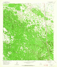
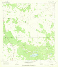
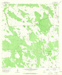
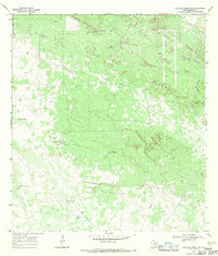
 1963 Flowella1964 Print · USGSBrooks County ranchlands in the early sixties show a landscape balancing traditional cattle operations with a growing oil economy. Researchers can trace family estates like Perez Ranch, visit the Pedro Jaramillo Cem, or locate the Gyp Hill Oil Field.
 - 1963 Map of Falfurrias SE, 1964 Print
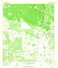
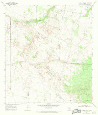
 1963 Falfurrias SE1964 Print · USGSBrooks County ranchlands meet the South Texas energy boom in the early sixties. Researchers can trace historic ranch boundaries and water sources like Old Barroso Windmill alongside industrial developments in the Pita Oil Field.2 unique versions available
 - 1963 Map of Premont West, 1964 Print
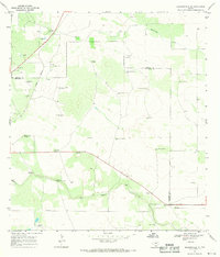
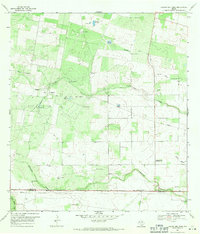
 1963 Premont West1964 Print · USGSJim Wells County in the early 1960s was a hub of energy production and ranching at the meeting point of three counties. Genealogists and historians can trace the Southern Pacific rail corridor through Premont and La Gloria, and locate rural landmarks like the La Gloria Sch and the Drive-in Theater.
 - 1963 Map of Cage Ranch, 1964 Print
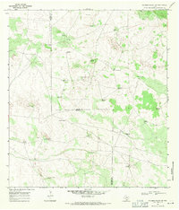
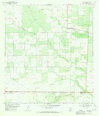
 1963 Cage Ranch1964 Print · USGSBrooks County is shown at the height of the early 1960s energy boom, where vast ranch lands meet industrial oil and gas fields. Researchers can trace family ranch boundaries like Cage Ranch and the rail stop at Dixie along the Southern Pacific line.
 - 1963 Map of Premont East, 1964 Print
 1963 Premont East1964 Print · USGSThe South Texas brush country at the height of the mid-century energy boom is captured here in detail. Researchers can trace the development of the Tijerina Canales Blucher Oil Field or locate family sites near Palobla and Premont.2 unique versions available
 - 1963 Map of Callo Padrones, 1965 Print
 1963 Callo Padrones1965 Print · USGSBrooks and Hidalgo counties were a landscape of vast ranching tracts and early oil exploration during the early sixties. Researchers can trace family ranching boundaries and water infrastructure through sites like Huisaches Alton Ranch and Viboras Well.2 unique versions available
 - 1963 Map of Encino, 1965 Print
 1963 Encino1965 Print · USGSThe South Texas brush country at the dawn of the 1960s reveals a landscape defined by ranching and oil extraction. Trace family roots and old land boundaries at Tepeguaje Ranch, Longoria Cem, and the cattle-loading stop at Rachal Siding.2 unique versions available
 - 1963 Map of San Tomas Camp, 1965 Print
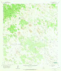 1963 San Tomas Camp1965 Print · USGSRanching operations in Brooks County are captured here in the early 1960s, showing a landscape defined by expansive pastures and essential water sources. Genealogists and historians can trace the bounds of Encino Ranch and locate remote sites like San Tomas Camp and Quiteria Hill.2 unique versions available
 - 1963 Map of Falfurrias, 1965 Print
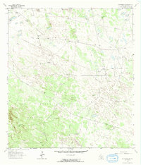
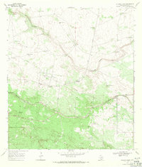
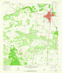 1963 Falfurrias1965 Print · USGSIn the early 1960s, the South Texas town of Falfurrias stood as a hub for both the cattle and energy industries. Genealogists and historians can trace local landmarks like Lasater Sch, the Drive-in Theater, and large landholdings such as Miller Ranch.2 unique versions available
 - 1963 Map of Hartland, 1965 Print
 1963 Hartland1965 Print · USGSThe ranching country along the Brooks and Hidalgo County border comes alive in the early sixties as a network of pastures and rail. Trace the Southern Pacific tracks past Hartland or locate family landmarks like Coyote Ranch and Buena Suerte Windmill.2 unique versions available
 - 1966 Map of Corpus Christi
 1966 Corpus Christi1966 Print · USGSThe Texas Coastal Bend in the mid-1960s reveals a landscape where massive cattle empires and strategic military bases meet the Gulf. Trace the vast reaches of King Ranch or locate aviation history at the Corpus Christi Air Station and Kingsville Air Station.
 - 1967 Map of Hebbronville SE, 1971 Print
 1967 Hebbronville SE1971 Print · USGSThe ranch lands of Jim Hogg County are captured here in the late sixties as the oil and gravel industries expanded across the brush country. Researchers can trace the Texas Mexican line and locate numerous family-named landmarks like Papalote Nuevo Windmill and San Tomas Windmill.2 unique versions available
 - 1968 Map of Palomas Ranch NW, 1971 Print
 1968 Palomas Ranch NW1971 Print · USGSBrooks County ranchlands in the late sixties show a landscape where water and oil dictate the pace of life. Genealogists and historians can trace family-named landmarks like the Trevino Windmill and Vaquero Windmill or locate a quiet Cem near the county line.
 - 1968 Map of Palomas Ranch SW, 1971 Print
 1968 Palomas Ranch SW1971 Print · USGSThe ranch lands of South Texas are captured in the late sixties, showcasing the vital water networks of the Brooks and Jim Hogg county line. Researchers can trace remote family landmarks like Garcia or flowing artesian sources such as the Rayado Well.2 unique versions available
 - 1968 Map of Palomas Ranch SE, 1971 Print
 1968 Palomas Ranch SE1971 Print · USGSRanching and resource extraction define this South Texas landscape in the late sixties. Researchers can locate remote family landmarks like Perez Cem and various named water sources such as Liescosa Well (Flowing) and Madrigueras Windmill.
 - 1968 Map of Palomas Ranch, 1971 Print
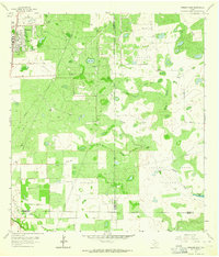
 1968 Palomas Ranch1971 Print · USGSThe arid ranchlands of Brooks County are captured here in the late sixties, showcasing a landscape shaped by water and oil. Genealogists and historians can trace the sites of Palomas Ranch, the Oil Field, and named landmarks like Coyote Windmill.
 - 1969 Map of Laguna Del Toro, 1971 Print
 1969 Laguna Del Toro1971 Print · USGSSouth Texas ranchlands near the Brooks and Duval county line are captured here in the late sixties, showing a landscape defined by cattle and crude. Researchers can trace family-named outposts and rural spiritual centers like Cibolo Ranch, Copita Cem, and Santa Pentecostes Ch.2 unique versions available
 - 1969 Map of Ramirez, 1971 Print
 1969 Ramirez1971 Print · USGSDuval County ranching and energy production are in focus during the late sixties. Trace family history and land use through named landmarks like Ramirez, Ramos Cem, and the numerous water sources such as Bobbies Windmill.
End of results
Showing maps 1-21 of 21
Top cities of Brooks County
Frequently asked questions
- What are the different types of historical maps available for Brooks County?
- What is the oldest map of Brooks County?
- Where can I purchase historical maps of Brooks County for my home or office?
- Where can I download high-res historical maps of Brooks County?
- Are there historical topographic maps available for Brooks County?
- Is there historical aerial imagery available for Brooks County?
- Where are historical maps of Brooks County sourced from?