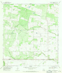
1969 Map of Laguna Del Toro
USGS Topo · Published 1971About this map
The Duval and Brooks County line bisects this South Texas landscape, defined by a sparse ranching economy and active petroleum extraction. Water is the primary driver of settlement patterns here, evidenced by the proliferation of named windmills such as the Novillo Windmill, Huisache Windmill, and Rancho Viejo Windmill that dot the arid terrain. These points of infrastructure supported isolated outposts like the Cibolo Ranch and Llano Windmill during the late 1960s.
Find a feature on this map
31 named features on this map. Tap any name to fly to it.
Don’t see what you’re looking for? This feature index may not catch every label — zoom into the map to look around manually.
Map Details
Editions of this 1969 Laguna Del Toro Map
2 editions found
Other maps of this area

1921 · Falfurrias
USGS Topo · 1:125,000

1956 · Laredo
USGS Topo · 1:250,000

1963 · Premont West
USGS Topo · 1:24,000

1963 · Falfurrias
USGS Topo · 1:24,000
1963 · Seeligson Ranch
USGS Topo · 1:24,000

1968 · Palomas Ranch NW
USGS Topo · 1:24,000

1968 · Concepcion
USGS Topo · 1:24,000

1968 · Concepcion NW
USGS Topo · 1:24,000

1968 · Palomas Ranch
USGS Topo · 1:24,000
1969 · Ramirez
USGS Topo · 1:24,000