1950s Maps of Brooks County, Texas
Explore 13 historic maps of Brooks County from the 1950s. These maps offer a rare glimpse into what life looked like during the 1950s — showing old roads, neighborhoods, homes, and landmarks that have changed or disappeared over time.
Whether you're researching your family's past, planning a metal detecting trip, or studying how Brooks County's landscape evolved across the 1950s, these high-resolution maps are a powerful tool for exploring the history of this region.
- Focus on a specific era: All maps on this page are from the 1950s, giving you a focused view of this time period.
- See what’s changed: Compare century-old streets, trails, and buildings to today's modern landscape using overlays and satellite layers.
- Research with precision: Use these maps for genealogy, historical research, land use analysis, or educational projects.
- View, download, or print: Maps are fully viewable online in high resolution, and can be downloaded or printed for your own records.
Start exploring Brooks County's history through authentic maps from the 1950s. This is your window into the past.
Brooks County, TX maps
(13)- 1950 Map of Corpus Christi, 1953 Print
 1950 Corpus Christi1953 Print · USGSThe South Texas coast comes into focus during the early fifties, showing the interplay between booming oil fields and expansive ranching operations. Genealogists and historians can trace the Texas Mexican rail line through Kingsville or locate heritage sites like Chapman Ranch and Riviera Beach.
 - 1953 Map of Brownsville
 1953 Brownsville1953 Print · USGSSouth Texas ranchlands and the Lower Rio Grande Valley are captured here in the early fifties as the region's irrigation and shipping networks expanded. Genealogists and historians can trace family landholdings like Tecolote Ranch or follow the route of the St Louis Brownsville and Mexico rail line through Sebastian and Yturria.
 - 1954 Map of McAllen
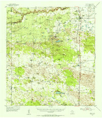
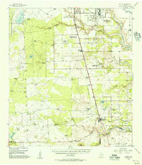
 1954 McAllen1954 Print · USGSCovers Brooks County, including Reynosa, McAllen, and other nearby areas
 - 1954 Map of Sarita, 1956 Print
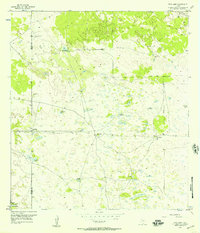
 1954 Sarita1956 Print · USGSThe ranching heart of South Texas comes into focus in the mid-1950s, centered on the railroad town of Sarita. Researchers can trace the massive cattle estates of the era, including La Paloma Ranch, and follow the Missouri Pacific line through landmarks like Turcotte.
 - 1954 Map of Riviera, 1957 Print
 1954 Riviera1957 Print · USGSKleberg County in the mid-fifties is captured here as a landscape of military aviation, large-scale ranching, and emerging oil fields. Researchers can trace family windmills, old school sites like San Fernando Sch, and the grounds of the Texas and Mexican Industrial Institute.
 - 1956 Map of Corpus Christi
 1956 Corpus Christi1956 Print · USGSThe South Texas coast and the burgeoning port of Corpus Christi are captured here during the mid-fifties. Genealogists and historians can trace the rail-and-oil economy through labels like Robstown Airpark, Chapman Ranch, and the Missouri Pacific railroad.
 - 1956 Map of Pita Camp, 1957 Print
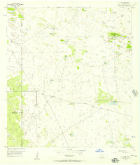
 1956 Pita Camp1957 Print · USGSThe ranchlands along the Brooks and Kenedy County line are mapped here in the mid-fifties, showing the essential water infrastructure of the era. Trace the locations of Pita Camp, Ball Ranch, and numerous landmarks like Zacahuistle Windmill.2 unique versions available
 - 1956 Map of Julian, 1957 Print
 1956 Julian1957 Print · USGSThe remote ranchlands of Kenedy and Brooks County are captured here in the mid-1950s, highlighting a landscape defined by industrial water management and oil exploration. Researchers can trace the network of private roads connecting Julian (Recycling Sta) and Chaparrosa Camp to numerous named sites like Candelaria Lake.2 unique versions available
 - 1956 Map of Armstrong, 1959 Print
 1956 Armstrong1959 Print · USGSKenedy County ranching and the rail corridor are preserved here in the mid-fifties. Researchers can trace the ranching economy at Armstrong Ranch Headquarters or find family history at the Norias Cem along the Missouri Pacific.
 - 1956 Map of Laredo, 1960 Print
 1956 Laredo1960 Print · USGSSouth Texas in the mid-fifties reveals a landscape shaped by border commerce, military aviation, and a booming oil industry. Trace the historic Texas and Mexican RR line through Hebbronville or locate the sprawling Mirando City Oil Field and Laredo AFB.3 unique versions available
 - 1956 Map of Brownsville, 1969 Print
 1956 Brownsville1969 Print · USGSThe Texas-Mexico borderlands and the Gulf coast come alive in this mid-century survey of the Rio Grande Valley. Genealogists and historians can trace the reach of the Missouri Pacific rail lines through citrus country to schools like Las Yescas and Palm Grove.2 unique versions available
 - 1956 Map of Port Isabel, 1983 Print
 1956 Port Isabel1983 Print · USGSCoastal Texas and the Rio Grande Valley are shown here in the mid-twentieth century as the region balanced intensive agriculture with maritime trade. Researchers can trace historic rail lines like the SOUTHERN PACIFIC and locate rural landmarks such as Las Yescas Sch or the Armstrong Ranch.
 - 1957 Map of Mc Allen, 1962 Print
 1957 Mc Allen1962 Print · USGSThe South Texas borderlands emerge in the late fifties as a hub of energy production and military activity. Researchers can trace the river economy through Rio Grande City, find the Brewster School, and locate the Moore Air Force Base.2 unique versions available
End of results
Showing maps 1-13 of 13
Top cities of Brooks County
Frequently asked questions
- What are the different types of historical maps available for Brooks County?
- What is the oldest map of Brooks County?
- Where can I purchase historical maps of Brooks County for my home or office?
- Where can I download high-res historical maps of Brooks County?
- Are there historical topographic maps available for Brooks County?
- Is there historical aerial imagery available for Brooks County?
- Where are historical maps of Brooks County sourced from?