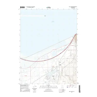
2017 Map of Mills Junction
USGS Topo · Published 2017About this map
Stansbury Park and Erda occupy the southeastern quadrant of this map, showcasing a blend of residential expansion and agricultural infrastructure between the Oquirrh Mountains and the Great Salt Lake. The landscape is defined by its water management, featuring the Stansbury Lake and Mill Pond residential areas alongside the Irrigation Canal and the marshes of the Eardley Spit. Local history is anchored by Adobe Rock, a distinct landmark near Mills Junction, where the intersection of transit and terrain has long influenced Tooele County development. Genealogists and local historians can find the Lake Point Cem near the northeastern corridor, while the Union Pacific Access Rd and labels like Lago indicate the ongoing role of the railroad in this transit-heavy corridor between Salt Lake City and the Great Basin.
Find a feature on this map
47 named features on this map. Tap any name to fly to it.
Don’t see what you’re looking for? This feature index may not catch every label — zoom into the map to look around manually.
Map Details
Editions of this 2017 Mills Junction Map
This is the sole edition of this map. No revisions or reprints were ever made.
Other maps of this area

1885 · Tooele Valley
USGS Topo · 1:250,000

1952 · Bingham Canyon
USGS Topo · 1:24,000

1952 · Antelope Island South
USGS Topo · 1:24,000

1952 · Garfield
USGS Topo · 1:24,000

1953 · Tooele
USGS Topo · 1:250,000

1955 · Mills Junction
USGS Topo · 1:24,000

1955 · Burmester
USGS Topo · 1:24,000

1955 · Grantsville
USGS Topo · 1:24,000

1955 · Tooele
USGS Topo · 1:250,000

1955 · Tooele
USGS Topo · 1:24,000