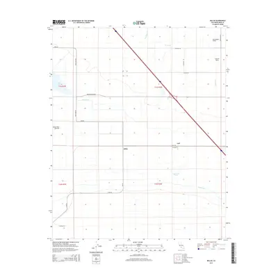
2015 Map of Millux
USGS Topo · Published 2015About this map
The Buena Vista Lake Bed dominates the central landscape of this Kern County survey, illustrating the heavily engineered hydrology of the southern San Joaquin Valley. Settlement centers on the small localities of Millux and Gulf, situated near a complex network of irrigation works including the Buena Vista Canal, Maple Canal, and the Stine Canal. These waterways, along with the Old Rim Ditch and Connecting Slough, trace the historical management of water in an area once defined by natural lake systems and seasonal overflow. Modern infrastructure is represented by a grid of arterial routes such as Bear Mountain Blvd and Coles Levee Rd, which segment the agricultural terrain of the Central Valley. North of the dry lake bed, Lake Webb provides a permanent water feature within this reclaimed basin.
Find a feature on this map
30 named features on this map. Tap any name to fly to it.
Don’t see what you’re looking for? This feature index may not catch every label — zoom into the map to look around manually.
Map Details
Editions of this 2015 Millux Map
This is the sole edition of this map. No revisions or reprints were ever made.
Other maps of this area

1910 · Buena Vista Lake
USGS Topo · 1:125,000

1912 · Buena Vista Lake
USGS Topo · 1:125,000

1929 · Stevens
USGS Topo · 1:31,680

1929 · Coles Levee
USGS Topo · 1:31,680

1929 · Mouth of Kern
USGS Topo · 1:31,680

1930 · Millux
USGS Topo · 1:31,680

1930 · Conner
USGS Topo · 1:31,680

1931 · Pentland Junction
USGS Topo · 1:31,680

1931 · Hayes Ranch
USGS Topo · 1:31,680

1932 · Mouth of Kern
USGS Topo · 1:31,680