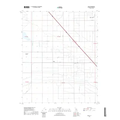
2018 Map of Millux
USGS Topo · Published 2018About this map
Millux and the neighboring locality of Gulf occupy a landscape deeply defined by the complex water management of the Central San Joaquin Valley. The map details a sophisticated network of agricultural infrastructure, including the Buena Vista Canal, Stine Canal, and Maple Canal, which crisscross the region to sustain the local economy. Dominating the western portion of the sheet is the Buena Vista Lake Bed, containing Lake Webb. This area illustrates the historical transformation of natural basins into managed reservoirs and irrigated plains. The geometric precision of the township boundaries, such as t31s r26e, and the strictly gridded road system—including Bear Mountain Blvd and Coles Levee Rd—reflect the large-scale land planning and intensive farming typical of this portion of Kern County.
Find a feature on this map
25 named features on this map. Tap any name to fly to it.
Don’t see what you’re looking for? This feature index may not catch every label — zoom into the map to look around manually.
Map Details
Editions of this 2018 Millux Map
This is the sole edition of this map. No revisions or reprints were ever made.
Other maps of this area

1910 · Buena Vista Lake
USGS Topo · 1:125,000

1912 · Buena Vista Lake
USGS Topo · 1:125,000

1929 · Stevens
USGS Topo · 1:31,680

1929 · Coles Levee
USGS Topo · 1:31,680

1929 · Mouth of Kern
USGS Topo · 1:31,680

1930 · Millux
USGS Topo · 1:31,680

1930 · Conner
USGS Topo · 1:31,680

1931 · Pentland Junction
USGS Topo · 1:31,680

1931 · Hayes Ranch
USGS Topo · 1:31,680

1932 · Mouth of Kern
USGS Topo · 1:31,680