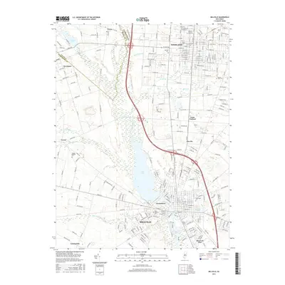
2016 Map of Millville
USGS Topo · Published 2016About this map
Union Lake and the Maurice River dominate this southern New Jersey landscape, serving as the central axis for the industrial and residential development of the region. The city of Millville occupies the southern bank, while the northern residential grids of Vineland stretch toward the boundary of Cumberland County. This 2016 survey documents a dense concentration of civic and genealogical landmarks, particularly its numerous burial grounds such as the Veterans Memorial Home Cem, the Carmel Hebrew Cem, and Mount Pleasant Cem.
Find a feature on this map
267 named features on this map. Tap any name to fly to it.
Don’t see what you’re looking for? This feature index may not catch every label — zoom into the map to look around manually.
Map Details
Editions of this 2016 Millville Map
This is the sole edition of this map. No revisions or reprints were ever made.
Other maps of this area

1890 · Hammonton
USGS Topo · 1:62,500

1890 · Tuckahoe
USGS Topo · 1:62,500

1890 · Bridgeton
USGS Topo · 1:62,500

1890 · Glassboro
USGS Topo · 1:62,500

1893 · Tuckahoe
USGS Topo · 1:62,500

1894 · Hammonton
USGS Topo · 1:62,500

1894 · Bridgeton
USGS Topo · 1:62,500

1898 · Glassboro
USGS Topo · 1:62,500

1898 · Hammonton
USGS Topo · 1:62,500

1899 · Vineland
USGS Topo · 1:125,000