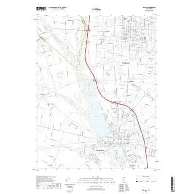
2019 Map of Millville
USGS Topo · Published 2019About this map
The Maurice River corridor and the expansive Union Lake dominate this 2019 survey of Cumberland County. These waters have long influenced the development of Millville and Vineland, which appear here with their established street grids and suburban expansions into places like South Vineland and Clayville. The map serves as a vital record for genealogists, documenting several significant burial grounds including the Carmel Hebrew Cem near Carmel, and the Greenwood Cem in the city center. The transition from the dense urban layouts of the city cores to the more rural outskirts is marked by tributary streams such as Tarkiln Br and White Marsh Run. This contemporary snapshot provides a clear look at modern transit infrastructure, including the heavy road networks of Landis Ave and Co Rd 552, while preserving the locations of older neighborhood anchors like Roosevelt Park.
Find a feature on this map
259 named features on this map. Tap any name to fly to it.
Don’t see what you’re looking for? This feature index may not catch every label — zoom into the map to look around manually.
Map Details
Editions of this 2019 Millville Map
This is the sole edition of this map. No revisions or reprints were ever made.
Other maps of this area

1890 · Hammonton
USGS Topo · 1:62,500

1890 · Tuckahoe
USGS Topo · 1:62,500

1890 · Bridgeton
USGS Topo · 1:62,500

1890 · Glassboro
USGS Topo · 1:62,500

1893 · Tuckahoe
USGS Topo · 1:62,500

1894 · Hammonton
USGS Topo · 1:62,500

1894 · Bridgeton
USGS Topo · 1:62,500

1898 · Glassboro
USGS Topo · 1:62,500

1898 · Hammonton
USGS Topo · 1:62,500

1899 · Vineland
USGS Topo · 1:125,000