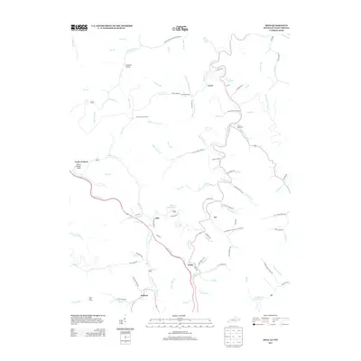
2013 Map of Milo
USGS Topo · Published 2013About this map
Martin County Lake serves as a central landmark in this deeply carved landscape of eastern Kentucky, where small communities follow the winding paths of the fork and branch network. Small settlements like Milo and Job are positioned along the watercourses, reflecting the traditional valley-based development of the region. Higher elevations are marked by features such as Peach Orchard Knob and the Orchard Lookout Tower, providing vantage points over the surrounding ridges. Local genealogy is preserved in the location of the Buffalo Horn Cem and Hammond Cem, while civic life is anchored by the Castle School and the post office near Castle. The dense network of local roads, such as Walker Fork-Bonithon Branch Rd and Big Laurel Rd, underscores the importance of these thoroughfares in connecting the isolated hollows and residential clusters.
Find a feature on this map
100 named features on this map. Tap any name to fly to it.
Don’t see what you’re looking for? This feature index may not catch every label — zoom into the map to look around manually.
Map Details
Editions of this 2013 Milo Map
This is the sole edition of this map. No revisions or reprints were ever made.
Other maps of this area

1886 · Prestonsburg
USGS Topo · 1:125,000

1887 · Warfield
USGS Topo · 1:125,000

1891 · Warfield
USGS Topo · 1:125,000

1892 · Prestonsburg
USGS Topo · 1:125,000

1892 · Huntington
USGS Topo · 1:125,000

1898 · Huntington
USGS Topo · 1:125,000

1903 · Kenova
USGS Topo · 1:125,000

1904 · Kenova
USGS Topo · 1:125,000

1909 · Wayne
USGS Topo · 1:62,500

1910 · Naugatuck
USGS Topo · 1:48,000