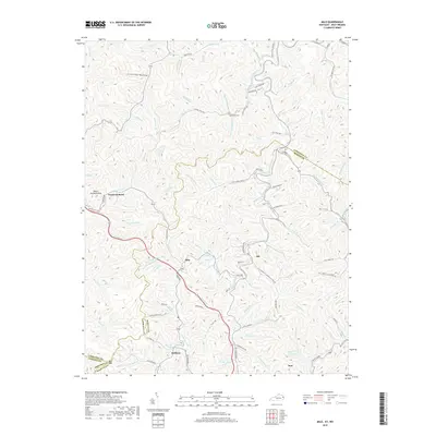
2019 Map of Milo
USGS Topo · Published 2019About this map
Rockcastle Creek winds through this corner of Martin and Lawrence counties, defining a landscape etched with narrow hollows and numerous small tributaries. The settlements of Peach Orchard and Milo serve as focal points in a region dominated by steep terrain, where ridges like Peach Orchard Knob overlook a network of branches and forks including Wolfpen Br and Maynard-Preece Br. The map reveals the deep-rooted local history of this coal-country area, with small communities such as Job and Stidham connected by winding roads like Milo RD. Genealogy researchers will find several family-named landmarks and quiet resting places, including the Hammond Cem near Laurel Cr and the Buffalo Horn Cem situated above the creek of the same name. Education in these hollows is represented by the Castle School, located along Cassell Branch.
Find a feature on this map
101 named features on this map. Tap any name to fly to it.
Don’t see what you’re looking for? This feature index may not catch every label — zoom into the map to look around manually.
Map Details
Editions of this 2019 Milo Map
This is the sole edition of this map. No revisions or reprints were ever made.
Other maps of this area

1886 · Prestonsburg
USGS Topo · 1:125,000

1887 · Warfield
USGS Topo · 1:125,000

1891 · Warfield
USGS Topo · 1:125,000

1892 · Prestonsburg
USGS Topo · 1:125,000

1892 · Huntington
USGS Topo · 1:125,000

1898 · Huntington
USGS Topo · 1:125,000

1903 · Kenova
USGS Topo · 1:125,000

1904 · Kenova
USGS Topo · 1:125,000

1909 · Wayne
USGS Topo · 1:62,500

1910 · Naugatuck
USGS Topo · 1:48,000