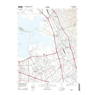
2015 Map of Milpitas
USGS Topo · Published 2015About this map
Coyote Creek meanders through the heart of the South Bay, separating the industrial corridors of Milpitas and San Jose from the extensive salt ponds of the bay shore. This 2015 survey documents the high-density urban development characteristic of the Silicon Valley era, showing the intersection of technology and education at sites like Silicon Valley Univ and Heald College San Jose. Along the shoreline, a complex network of waterways including Alviso Slough and Artesian Slough highlights the managed landscape of Station Island and various salt ponds. The map captures the older residential and industrial pockets of Agnew and the Warm Springs District, alongside the modern logistics hubs that have grown around the Southern Pacific RR lines. Of particular note for local history is the Cedar Lawn Memorial Cemetery and the specialized campus of the Palmer Coll of Chiropractic W Campus near the Guadalupe River.
Find a feature on this map
289 named features on this map. Tap any name to fly to it.
Don’t see what you’re looking for? This feature index may not catch every label — zoom into the map to look around manually.
Map Details
Editions of this 2015 Milpitas Map
This is the sole edition of this map. No revisions or reprints were ever made.
Other maps of this area

1889 · San Jose
USGS Topo · 1:62,500

1897 · San Jose
USGS Topo · 1:62,500

1897 · Palo Alto
USGS Topo · 1:62,500

1899 · San Jose
USGS Topo · 1:62,500

1899 · Palo Alto
USGS Topo · 1:62,500

1899 · Haywards
USGS Topo · 1:62,500

1902 · Santa Cruz
USGS Topo · 1:125,000

1906 · Pleasanton
USGS Topo · 1:62,500

1915 · Haywards
USGS Topo · 1:62,500

1941 · Pleasanton
USGS Topo · 1:62,500