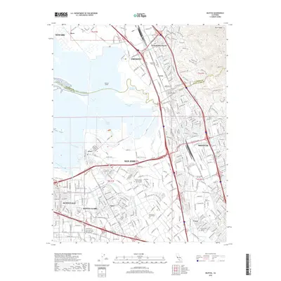
2018 Map of Milpitas
USGS Topo · Published 2018About this map
The complex wetland interface of the South San Francisco Bay dominates this landscape, where the Guadalupe River and Coyote Creek meet a network of tidal channels including North Coyote Slough and Artesian Slough. The area reflects a transition from salt marshes and sloughs into the dense urban development of San Jose and Milpitas. Long-standing communities such as Alviso and Agnew are shown alongside the industrial corridors served by the Union Pacific RR.
Find a feature on this map
341 named features on this map. Tap any name to fly to it.
Don’t see what you’re looking for? This feature index may not catch every label — zoom into the map to look around manually.
Map Details
Editions of this 2018 Milpitas Map
This is the sole edition of this map. No revisions or reprints were ever made.
Other maps of this area

1889 · San Jose
USGS Topo · 1:62,500

1897 · San Jose
USGS Topo · 1:62,500

1897 · Palo Alto
USGS Topo · 1:62,500

1899 · San Jose
USGS Topo · 1:62,500

1899 · Palo Alto
USGS Topo · 1:62,500

1899 · Haywards
USGS Topo · 1:62,500

1902 · Santa Cruz
USGS Topo · 1:125,000

1906 · Pleasanton
USGS Topo · 1:62,500

1915 · Haywards
USGS Topo · 1:62,500

1941 · Pleasanton
USGS Topo · 1:62,500