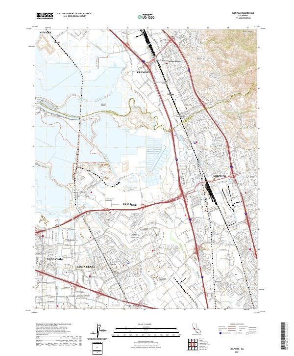
2021 Map of Milpitas
USGS Topo · Published 2021About this map
Coyote Creek and its many meandering sloughs, such as Artesian Slough and Mud Slough, dominate the landscape where the south bay wetlands meet the industrial and residential heart of Silicon Valley. This 2021 survey shows the intensive suburban development of Milpitas and San Jose, though traces of the area's older identities remain in place names like Agnew and Wayne. The map details the complex drainage systems of the Diablo Range foothills, including Agua Caliente Cr and Scott Cr, which flow through heavily engineered corridors toward the bay.
Find a feature on this map
202 named features on this map. Tap any name to fly to it.
Don’t see what you’re looking for? This feature index may not catch every label — zoom into the map to look around manually.
Map Details
Editions of this 2021 Milpitas Map
This is the sole edition of this map. No revisions or reprints were ever made.
Other maps of this area

1889 · San Jose
USGS Topo · 1:62,500

1897 · San Jose
USGS Topo · 1:62,500

1897 · Palo Alto
USGS Topo · 1:62,500

1899 · San Jose
USGS Topo · 1:62,500

1899 · Palo Alto
USGS Topo · 1:62,500

1899 · Haywards
USGS Topo · 1:62,500

1902 · Santa Cruz
USGS Topo · 1:125,000

1906 · Pleasanton
USGS Topo · 1:62,500

1915 · Haywards
USGS Topo · 1:62,500

1941 · Pleasanton
USGS Topo · 1:62,500