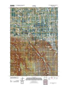
2011 Map of Milton-Freewater
USGS Topo · Published 2011About this map
Milton-Freewater and its surrounding agricultural valley are defined by a complex irrigation network of canals and creeks in this 2011 survey. The landscape is etched with historical water management features like the Hudson Bay Canal, Milton Ditch, and Pleasant View Canal, which support local production such as Davis Orchards. Smaller settlements like Ferndale, Crockett, and Umapine dot the region, connected by a dense grid of rural roads named for local families. Genealogists can locate several burial sites, including Ford Cemetery and Old City Cemetery. The transit history of the area is noted at the W. W. V. Ry. Crossing, while the southern reaches rise toward Milton Hill and the seasonal drainages of Dry Hollow.
Find a feature on this map
86 named features on this map. Tap any name to fly to it.
Don’t see what you’re looking for? This feature index may not catch every label — zoom into the map to look around manually.
Map Details
Editions of this 2011 Milton-Freewater Map
This is the sole edition of this map. No revisions or reprints were ever made.
Other maps of this area

1915 · Wallulah
USGS Topo · 1:96,000

1918 · Wallula
USGS Topo · 1:125,000

1919 · Walla Walla
USGS Topo · 1:125,000

1921 · Walla Walla
USGS Topo · 1:125,000

1935 · Pendleton
USGS Topo · 1:125,000

1953 · Pendleton
USGS Topo · 1:250,000

1953 · Walla Walla
USGS Topo · 1:250,000

1956 · Pendleton
USGS Topo · 1:250,000

1958 · Walla Walla
USGS Topo · 1:250,000

1964 · Milton-Freewater
USGS Topo · 1:24,000