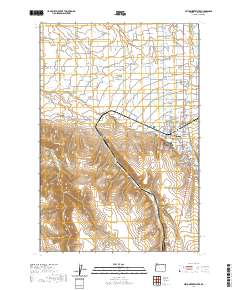
2020 Map of Milton-Freewater
USGS Topo · Published 2020About this map
Milton-Freewater sits at the heart of this landscape, where the fertile Walla Walla Valley transitions into the rising terrain of Milton Hill. The settlement pattern follows a complex network of water management and transport, with the Walla Walla River and its various distributaries, such as the Little Walla Walla River and E Prong Little Walla Walla River, supporting the local agriculture. Human engineering is evident in the presence of the Hudson Bay Canal, Pleasant View Canal, and Milton Ditch, which redirect water across the valley floor to support the numerous orchards and farms that define the region.
Find a feature on this map
76 named features on this map. Tap any name to fly to it.
Don’t see what you’re looking for? This feature index may not catch every label — zoom into the map to look around manually.
Map Details
Editions of this 2020 Milton-Freewater Map
This is the sole edition of this map. No revisions or reprints were ever made.
Other maps of this area

1915 · Wallulah
USGS Topo · 1:96,000

1918 · Wallula
USGS Topo · 1:125,000

1919 · Walla Walla
USGS Topo · 1:125,000

1921 · Walla Walla
USGS Topo · 1:125,000

1935 · Pendleton
USGS Topo · 1:125,000

1953 · Pendleton
USGS Topo · 1:250,000

1953 · Walla Walla
USGS Topo · 1:250,000

1956 · Pendleton
USGS Topo · 1:250,000

1958 · Walla Walla
USGS Topo · 1:250,000

1964 · Milton-Freewater
USGS Topo · 1:24,000