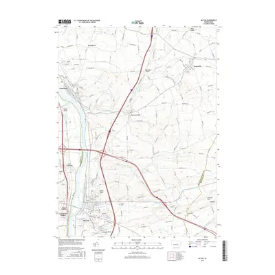
2016 Map of Milton
USGS Topo · Published 2016About this map
The West Branch Susquehanna River flows through this 2016 survey, defining the boundaries between Union and Northumberland counties. The river valley is densely settled, anchored by the borough of Milton at the southern edge and Watsontown to the north. These industrial and residential hubs are connected by a network of historical routes, including the Susquehanna Trl, which parallels the waterway. Away from the river, the landscape transitions into the agricultural fields and small communities of the Susquehanna Valley. Small settlements like Turbotville and McEwensville are situated among rolling hills, while Limestone Ridge provides a distinct topographic boundary to the southeast. Genealogists will find a wealth of local records in the numerous burial grounds, including the Milton Cem, Harmony Cem, and Saint Josephs Cem, which reflect the long-standing family lineages of this Central Pennsylvania region.
Find a feature on this map
38 named features on this map. Tap any name to fly to it.
Don’t see what you’re looking for? This feature index may not catch every label — zoom into the map to look around manually.
Map Details
Editions of this 2016 Milton Map
This is the sole edition of this map. No revisions or reprints were ever made.
Other maps of this area

1892 · Shamokin
USGS Topo · 1:62,500

1893 · Sunbury
USGS Topo · 1:62,500

1893 · Shamokin
USGS Topo · 1:62,500

1924 · Milton
USGS Topo · 1:62,500

1935 · Hughesville
USGS Topo · 1:62,500

1943 · Shamokin
USGS Topo · 1:62,500

1943 · Sunbury
USGS Topo · 1:62,500

1950 · Harrisburg
USGS Topo · 1:250,000

1952 · Shamokin
USGS Topo · 1:62,500

1953 · Hughesville
USGS Topo · 1:62,500