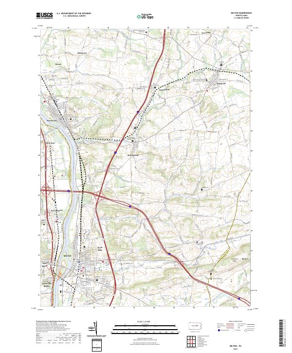
2023 Map of Milton
USGS Topo · Published 2023About this map
The West Branch Susquehanna River carves a central path through this portion of Northumberland and Union counties, anchoring a network of industrial towns and agricultural valleys. Modern infrastructure including I-80 and I-180 bisects the landscape, yet the map preserves the deep-rooted footprint of earlier generations through its numerous religious and memorial sites. Significant local landmarks like the Warrior Run Church Cem and the McEwensville Presbyterian Church speak to the area’s 18th and 19th-century Scots-Irish and German settlement patterns.
Find a feature on this map
57 named features on this map. Tap any name to fly to it.
Don’t see what you’re looking for? This feature index may not catch every label — zoom into the map to look around manually.
Map Details
Editions of this 2023 Milton Map
This is the sole edition of this map. No revisions or reprints were ever made.
Other maps of this area

1892 · Shamokin
USGS Topo · 1:62,500

1893 · Sunbury
USGS Topo · 1:62,500

1893 · Shamokin
USGS Topo · 1:62,500

1924 · Milton
USGS Topo · 1:62,500

1935 · Hughesville
USGS Topo · 1:62,500

1943 · Shamokin
USGS Topo · 1:62,500

1943 · Sunbury
USGS Topo · 1:62,500

1950 · Harrisburg
USGS Topo · 1:250,000

1952 · Shamokin
USGS Topo · 1:62,500

1953 · Hughesville
USGS Topo · 1:62,500