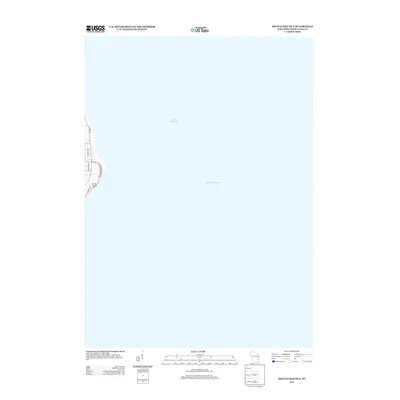
2013 Map of Milwaukee OE E
USGS Topo · Published 2013About this map
Lake Michigan dominates this coastal perspective, where the city grid of Milwaukee meets the western shoreline of the Great Lakes. The map focuses on the prominent landform at North Point, a significant geographical marker along the lakefront. The residential and recreational character of this lakeside area is defined by its street orientation, including N Lincoln Memorial Dr winding along the immediate coast and N Lake Dr running parallel further inland. This survey provides a precise look at the urban edge and shoreline geometry during the early 21st century, illustrating the relationship between the built environment and the expansive waters of Lake Michigan.
Find a feature on this map
8 named features on this map. Tap any name to fly to it.
Don’t see what you’re looking for? This feature index may not catch every label — zoom into the map to look around manually.
Map Details
Editions of this 2013 Milwaukee OE E Map
This is the sole edition of this map. No revisions or reprints were ever made.
Other maps of this area

1891 · Bayview
USGS Topo · 1:62,500

1892 · Milwaukee
USGS Topo · 1:62,500

1901 · Milwaukee
USGS Topo · 1:62,500

1901 · Bayview
USGS Topo · 1:62,500

1906 · Milwaukee
USGS Topo · 1:62,500

1954 · Milwaukee
USGS Topo · 1:250,000

1958 · Milwaukee
USGS Topo · 1:250,000
1958 · Milwaukee
USGS Topo · 1:24,000
1958 · Milwaukee
USGS Topo · 1:62,500
1958 · Thiensville
USGS Topo · 1:24,000