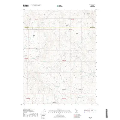
2018 Map of Mina
USGS Topo · Published 2018About this map
Mina stands as the primary named settlement in this high-elevation landscape along the border of Trinity and Mendocino counties. The drainage of the North Fork Eel River defines the western terrain, fed by a complex network of seasonal creeks and springs including Asbill Cr and Ram Spring Cr. Moving east, the topography is punctuated by distinctive peaks and basins, such as Wildhorse Peak and Panther Basin. The presence of scattered upland flats and valleys, including Wylettie Flat, Summit Valley, and Pine Flat, suggests a history of remote ranching or seasonal grazing. Unique water features like Who Who Lake and Lowrey Lake sit tucked between ridges, while roads like Mina Rd and Bald Mountain Rd provide the only access through the rugged gulches and canyons.
Find a feature on this map
49 named features on this map. Tap any name to fly to it.
Don’t see what you’re looking for? This feature index may not catch every label — zoom into the map to look around manually.
Map Details
Editions of this 2018 Mina Map
This is the sole edition of this map. No revisions or reprints were ever made.
Other maps of this area

1920 · Covelo
USGS Topo · 1:62,500

1921 · Hoaglin
USGS Topo · 1:62,500

1922 · Island Mountain
USGS Topo · 1:62,500

1926 · Covelo
USGS Topo · 1:62,500

1931 · Hoaglin
USGS Topo · 1:96,000

1935 · Hoaglin
USGS Topo · 1:125,000

1952 · Spyrock
USGS Topo · 1:62,500

1952 · Covelo
USGS Topo · 1:62,500

1953 · Blackrock Mtn
USGS Topo · 1:62,500

1954 · Blackrock Mtn
USGS Topo · 1:62,500