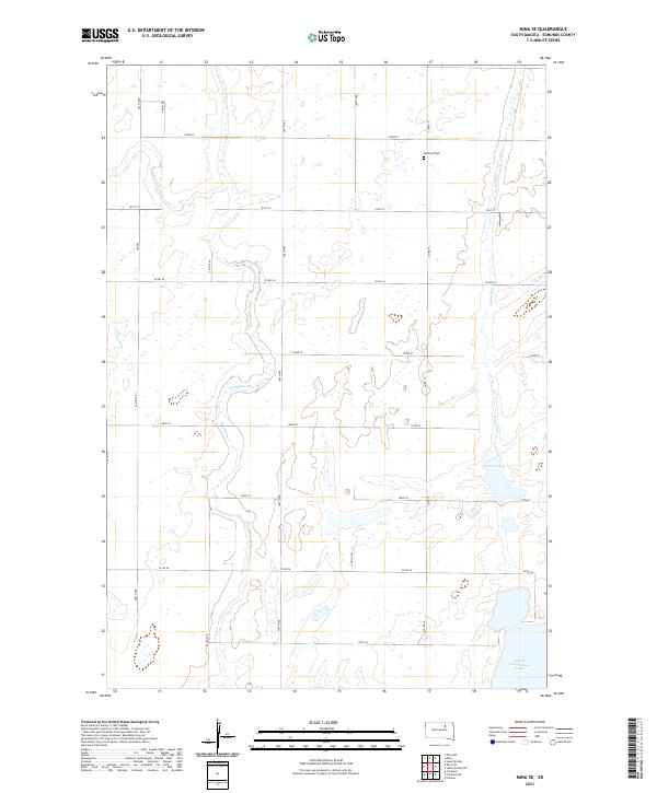
2021 Map of Mina SE
USGS Topo · Published 2021About this map
Richland Cem stands as a solitary landmark in this agricultural landscape of Edmunds County, situated near the intersection of Co Rd 15 and 140th St. The terrain is defined by a network of drainage ways and seasonal basins, most notably the winding courses of Preachers Run and Stony Run which navigate through the township grids of t122n r67w and t121n r66w. To the southeast, the geography shifts toward more permanent water bodies, featuring the margins of Grass Lake and the northern reaches of North Scatterwood Lake. This survey illustrates the precise section-line road system that organizes the region, with routes like 366th Ave and Co Rd 26 providing the primary framework for the local rural community and its scattered farmsteads.
Find a feature on this map
22 named features on this map. Tap any name to fly to it.
Don’t see what you’re looking for? This feature index may not catch every label — zoom into the map to look around manually.
Map Details
Editions of this 2021 Mina SE Map
This is the sole edition of this map. No revisions or reprints were ever made.
Other maps of this area

1899 · Northville
USGS Topo · 1:125,000

1954 · Aberdeen
USGS Topo · 1:250,000

1956 · Aberdeen
USGS Topo · 1:250,000
1966 · Chelsea
USGS Topo · 1:24,000
1966 · Cresbard NE
USGS Topo · 1:24,000

1966 · Cresbard
USGS Topo · 1:24,000

1970 · Lake Parmley
USGS Topo · 1:24,000

1970 · Mina SW
USGS Topo · 1:24,000
1970 · Lake Parmley SW
USGS Topo · 1:24,000

1970 · Mina NW
USGS Topo · 1:24,000