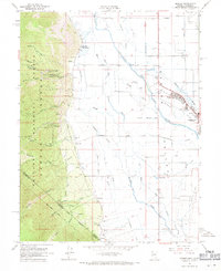
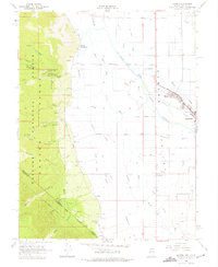
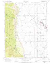
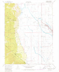
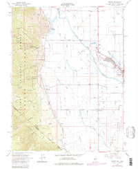
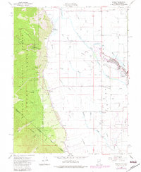
1968 Map of Minden
USGS Topo · Published 1971About this map
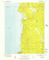
The Carson Valley floor is defined by an intricate network of irrigation ditches and sloughs during the late 1960s, a testament to the agricultural foundations of Douglas County. The East Fork Carson River and its counterparts like Williams Slough and Martin Slough dominate the lowlands, supporting the settlements of Minden and Gardnerville. To the west, the landscape rises sharply into the Toiyabe National Forest, where the Kingsbury Grade winds through Haines Canyon toward the Sierra Nevada crest. Genealogists will find significant local value in the recorded locations of Mottsville Cem, Gardnerville Cem, and the Captain George Cem. From the thermal waters at Walleys Hot Springs to the industrial presence of the Douglas Co Airport and numerous Gravel Pits, the map documents a valley balancing ranching heritage with mid-century development.
Find a feature on this map
58 named features on this map. Tap any name to fly to it.
Don’t see what you’re looking for? This feature index may not catch every label — zoom into the map to look around manually.
Map Details
Editions of this 1968 Minden Map
6 editions found
Other maps of this area

1889 · Markleeville
USGS Topo · 1:125,000

1891 · Carson
USGS Topo · 1:125,000

1891 · Markleeville
USGS Topo · 1:125,000

1893 · Carson
USGS Topo · 1:125,000

1893 · Markleeville
USGS Topo · 1:125,000

1948 · Walker Lake
USGS Topo · 1:250,000
1955 · Freel Peak
USGS Topo · 1:24,000
1955 · Bijou
USGS Topo · 1:24,000
1955 · Glenbrook
USGS Topo · 1:24,000

1956 · Freel Peak
USGS Topo · 1:62,500